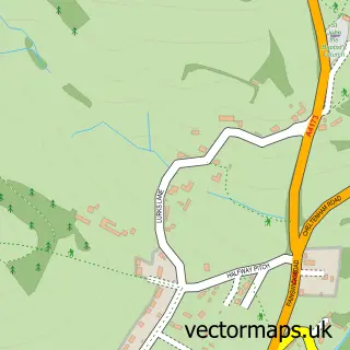
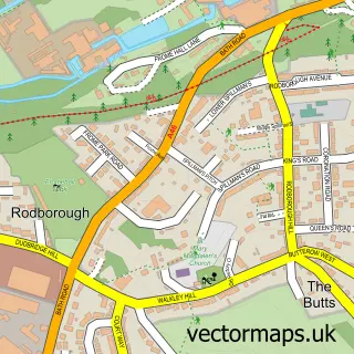
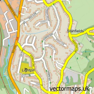
This Whiteshill street map is a detailed vector street map covering a 750m x 750m area. Select a larger area to create and download your own vector street map of Whiteshill.
The 750-metre map sample for Whiteshill covers 298 mapped buildings and approximately 33.8 km of road detail, of which 12 named roads are named. The immediate area includes 1 school, 3 GP surgeries within 2 miles and 10 MOT stations within 2 miles. To create a larger or custom map of Whiteshill, the map builder lets you define your own coverage area and download editable SVG, PDF and PNG files.
Create a larger editable map of Whiteshill
Choose any area you need and generate a high-quality vector map instantly. Perfect for print, planning, design, business and personal use.

This Whiteshill street map in Gloucestershire is available as downloadable SVG, PDF and PNG map files, or as a printed map for planning, business, display, education, local information and design work. You can also create a larger custom map area using the map selector.
What this Whiteshill map sample shows
Whiteshill lies within Whiteshill And Ruscombe Cp parish, part of Randwick, Whiteshill And Ruscombe ward in the Stroud District local authority area. The postcode geography for this area includes the GL postcode area, the GL6 postcode district and the GL6 6 postcode sector. Residents fall under the Nhs Gloucestershire Integrated Care Board for NHS services.
Local features near Whiteshill
Within 2 milesAmenities and services in and around Whiteshill.
Administrative and postcode information for Whiteshill
Whiteshill lies within Whiteshill And Ruscombe Cp parish, part of Randwick, Whiteshill And Ruscombe ward in the Stroud District local authority area. The postcode geography for this area includes the GL postcode area, the GL6 postcode district and the GL6 6 postcode sector. Residents fall under the Nhs Gloucestershire Integrated Care Board for NHS services.
Nearby street map samples around Whiteshill

More street maps in Gloucestershire
750 metre map area coverage
Boundary, postcode and point of interest information for the 750m x 750m rectangle centred on this sample map.
Boundaries containing map centre
Constituency: Stroud Co Const
County: Gloucestershire County
District: Stroud District
Icb: NHS Gloucestershire ICB
Parish: Whiteshill and Ruscombe CP
Police Force: gloucestershire
Postcode District: GL6
Postcode Sector: GL6 6
Ward: Randwick, Whiteshill & Ruscombe Ward
Nearby boundaries intersecting sample
Constituency: North Cotswolds Co Const
Parish: Pitchcombe CP
Ward: Hardwicke Ward, Painswick & Upton Ward
Postcode coverage
POI category counts
Health And Medical: 2
Construction Services: 1
Elementary School: 1
Financial Service: 1
Grocery Store: 1
It Service And Computer Repair: 1
Photography Store And Services: 1
Professional Services: 1
Tutoring Center: 1
Sample points of interest
- Houseproud Construction
- Whiteshill Primary School
- Lief Financial Services
- Ruscombe & Whiteshill Village Shop
- Healthy House
- The Healthy House
- Bring It Together
- Maggie Booth Photography
- Serene Communications
- Kumon
Create a larger editable map of Whiteshill
This sample shows only a 750 metre area. To create a larger map of Whiteshill, use our map builder to choose your own coverage area, add titles and download editable SVG, PDF and PNG files.
Create a custom map of Whiteshill