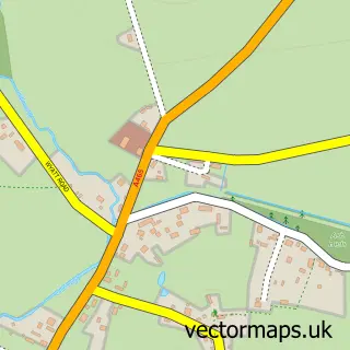
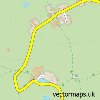
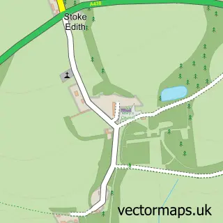
This Withington street map is a detailed vector street map covering a 750m x 750m area. Select a larger area to create and download your own vector street map of Withington.
The 750-metre map sample for Withington covers 163 mapped buildings and approximately 34.1 km of road detail, of which 5 named roads are named. The immediate area includes 1 school and 1 MOT station within 2 miles. To create a larger or custom map of Withington, the map builder lets you define your own coverage area and download editable SVG, PDF and PNG files.
Create a larger editable map of Withington
Choose any area you need and generate a high-quality vector map instantly. Perfect for print, planning, design, business and personal use.

This Withington street map in Herefordshire is available as downloadable SVG, PDF and PNG map files, or as a printed map for planning, business, display, education, local information and design work. You can also create a larger custom map area using the map selector.
What this Withington map sample shows
Withington lies within Withington Cp parish, part of Hagley ward in the County Of Herefordshire local authority area. The postcode geography for this area includes the HR postcode area, the HR1 postcode district and the HR1 3 postcode sector. Residents fall under the Nhs Herefordshire And Worcestershire Integrated Care Board for NHS services.
Local features near Withington
Within 2 milesAmenities and services in and around Withington.
Administrative and postcode information for Withington
The local authority covering Withington is County Of Herefordshire, within the county of Herefordshire. The settlement lies within Hagley ward and Withington Cp civil parish. The HR1 postcode district and HR1 3 postcode sector serve the immediate area. NHS provision in the area is delivered through Wye Valley Nhs Trust.
Nearby street map samples around Withington

More street maps in Herefordshire
750 metre map area coverage
Boundary, postcode and point of interest information for the 750m x 750m rectangle centred on this sample map.
Boundaries containing map centre
Constituency: North Herefordshire Co Const
District: County of Herefordshire
Icb: NHS Herefordshire and Worcestershire ICB
Parish: Withington CP
Police Force: west mercia
Postcode District: HR1
Postcode Sector: HR1 3
Ward: Hagley Ward
Nearby boundaries intersecting sample
No additional intersecting boundaries found.
Postcode coverage
POI category counts
Anglican Church: 1
Business Consulting: 1
Caterer: 1
Dog Trainer: 1
Elementary School: 1
Language School: 1
Music School: 1
Naturopathic Holistic: 1
Sports And Recreation Venue: 1
Sample points of interest
- St Peter, Withington
- Total Technology Consultants
- Kanamada Catering Ltd
- Hereford K9s
- Withington Primary School
- Fun French And Spanish - LCF Clubs - ALISON BAINBRIDGE
- Groove 'N' Move
- Amanda and Rachel Hypnotherapy and Regression
- Withington Village Hall
Create a larger editable map of Withington
This sample shows only a 750 metre area. To create a larger map of Withington, use our map builder to choose your own coverage area, add titles and download editable SVG, PDF and PNG files.
Create a custom map of Withington