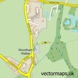
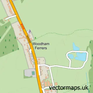
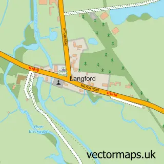
This Woodham Mortimer street map is a detailed vector street map covering a 750m x 750m area. Select a larger area to create and download your own vector street map of Woodham Mortimer.
The 750-metre map sample for Woodham Mortimer covers 159 mapped buildings and approximately 8.8 km of road detail, of which 7 named roads are named. The immediate area includes 1 GP surgery within 2 miles, 1 pub and 3 MOT stations within 2 miles. The wider area around Woodham Mortimer features 1 food and drink venue. To create a larger or custom map of Woodham Mortimer, the map builder lets you define your own coverage area and download editable SVG, PDF and PNG files.
Create a larger editable map of Woodham Mortimer
Choose any area you need and generate a high-quality vector map instantly. Perfect for print, planning, design, business and personal use.

This Woodham Mortimer street map in Essex is available as downloadable SVG, PDF and PNG map files, or as a printed map for planning, business, display, education, local information and design work. You can also create a larger custom map area using the map selector.
What this Woodham Mortimer map sample shows
Woodham Mortimer lies within Woodham Mortimer Cp parish, part of Wickham Bishops And Woodham ward in the Maldon District (B) local authority area. The postcode geography for this area includes the CM postcode area, the CM9 postcode district and the CM9 6 postcode sector. Residents fall under the Nhs Mid And South Essex Integrated Care Board for NHS services.
Local features near Woodham Mortimer
Within 2 milesAmenities and services in and around Woodham Mortimer.
Administrative and postcode information for Woodham Mortimer
Woodham Mortimer lies within Woodham Mortimer Cp parish, part of Wickham Bishops And Woodham ward in the Maldon District (B) local authority area. The postcode geography for this area includes the CM postcode area, the CM9 postcode district and the CM9 6 postcode sector. Residents fall under the Nhs Mid And South Essex Integrated Care Board for NHS services.
Nearby street map samples around Woodham Mortimer

More street maps in Essex
750 metre map area coverage
Boundary, postcode and point of interest information for the 750m x 750m rectangle centred on this sample map.
Boundaries containing map centre
Constituency: Witham Co Const
County: Essex County
District: Maldon District (B)
Icb: NHS Essex ICB
Parish: Woodham Mortimer CP
Police Force: essex
Postcode District: CM9
Postcode Sector: CM9 6
Ward: Wickham Bishops and Woodham Ward
Nearby boundaries intersecting sample
No additional intersecting boundaries found.
Postcode coverage
POI category counts
Land Surveying: 3
Sporting Goods: 2
Antique Store: 1
Driving Range: 1
Electrician: 1
Financial Advising: 1
Financial Service: 1
Preschool: 1
Pub: 1
Sample points of interest
- Antiques by Design
- Woodham Mortimer Golf Range
- Pegrum Electrical Ltd.
- A B Compliance
- The Taxidermy Law Co LLP
- Abode Surveyors
- Abode Surveyors Ltd.
- King Property Surveying Limited
- Woodham Mortimer Pre-school
- The Hurdlemakers Arms
- Custom-Fit Golf
- Steve Parkin Golf
Create a larger editable map of Woodham Mortimer
This sample shows only a 750 metre area. To create a larger map of Woodham Mortimer, use our map builder to choose your own coverage area, add titles and download editable SVG, PDF and PNG files.
Create a custom map of Woodham Mortimer