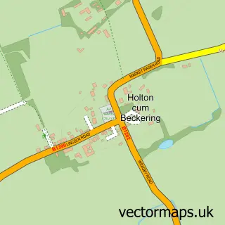
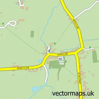
This Wragby street map is a detailed vector street map covering a 750m x 750m area. Select a larger area to create and download your own vector street map of Wragby.
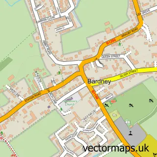
The 750-metre map sample for Wragby covers 413 mapped buildings and approximately 12.0 km of road detail, of which 27 named roads are named. The immediate area includes 1 school, 1 GP surgery, 4 pubs and 1 MOT station within 2 miles. The wider area around Wragby features 5 food and drink venues. To create a larger or custom map of Wragby, the map builder lets you define your own coverage area and download editable SVG, PDF and PNG files.
Create a larger editable map of Wragby
Choose any area you need and generate a high-quality vector map instantly. Perfect for print, planning, design, business and personal use.

This Wragby street map in Lincolnshire is available as downloadable SVG, PDF and PNG map files, or as a printed map for planning, business, display, education, local information and design work. You can also create a larger custom map area using the map selector.
What this Wragby map sample shows
Wragby lies within Wragby Cp parish, part of Wragby ward in the East Lindsey District local authority area. The postcode geography for this area includes the LN postcode area, the LN8 postcode district and the LN8 5 postcode sector. Residents fall under the Nhs Lincolnshire Integrated Care Board for NHS services.
Local features near Wragby
Within 2 milesAmenities and services in and around Wragby.
Administrative and postcode information for Wragby
The local authority covering Wragby is East Lindsey District, within the county of Lincolnshire. The settlement lies within Wragby ward and Wragby Cp civil parish. The LN8 postcode district and LN8 5 postcode sector serve the immediate area. NHS provision in the area is delivered through United Lincolnshire Hospitals Nhs Trust.
Nearby street map samples around Wragby

More street maps in Lincolnshire
750 metre map area coverage
Boundary, postcode and point of interest information for the 750m x 750m rectangle centred on this sample map.
Boundaries containing map centre
Constituency: Louth and Horncastle Co Const
County: Lincolnshire County
District: East Lindsey District
Icb: NHS Lincolnshire ICB
Parish: Wragby CP
Police Force: lincolnshire
Postcode District: LN8
Postcode Sector: LN8 5
Ward: Wragby Ward
Nearby boundaries intersecting sample
No additional intersecting boundaries found.
Postcode coverage
POI category counts
Convenience Store: 4
Pub: 4
Antique Store: 2
Charity Organization: 2
Financial Service: 2
Hair Salon: 2
Pet Store: 2
Accountant: 1
Acupuncture: 1
Anglican Church: 1
Sample points of interest
- Socius Accountants
- Old Court Acupuncture
- Wragby Group
- Lincs Veterinary Solutions
- Just The Thing Antiques
- Just The Thing Antiques
- Lincolnshire Co-op- Wragby
- Kevin Green Vehicle Air Conditioning Services
- Samantha Louise Nails Lashes Tanning
- Abbey Joinery
- Corn Dolly
- Wragby ChEF
Create a larger editable map of Wragby
This sample shows only a 750 metre area. To create a larger map of Wragby, use our map builder to choose your own coverage area, add titles and download editable SVG, PDF and PNG files.
Create a custom map of Wragby