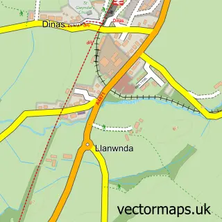
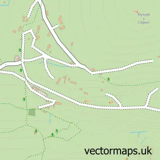
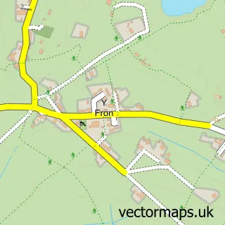
This Y Groeslon street map is a detailed vector street map covering a 750m x 750m area. Select a larger area to create and download your own vector street map of Y Groeslon.
The 750-metre map sample for Y Groeslon covers 257 mapped buildings and approximately 13.9 km of road detail, of which 14 named roads are named. The immediate area includes 1 GP surgery within 2 miles, 2 pubs and 5 MOT stations within 2 miles. The wider area around Y Groeslon features 2 food and drink venues and 1 campsite within 2 miles. To create a larger or custom map of Y Groeslon, the map builder lets you define your own coverage area and download editable SVG, PDF and PNG files.
Create a larger editable map of Y Groeslon
Choose any area you need and generate a high-quality vector map instantly. Perfect for print, planning, design, business and personal use.

This Y Groeslon street map in Gwynedd is available as downloadable SVG, PDF and PNG map files, or as a printed map for planning, business, display, education, local information and design work. You can also create a larger custom map area using the map selector.
What this Y Groeslon map sample shows
Y Groeslon lies within Llandwrog Community parish, part of Groeslon ward in the Gwynedd - Gwynedd local authority area. The postcode geography for this area includes the LL postcode area, the LL54 postcode district and the LL54 7 postcode sector. Residents fall under the Betsi Cadwaladr University Health Board for NHS services.
Local features near Y Groeslon
Within 2 milesAmenities and services in and around Y Groeslon.
Administrative and postcode information for Y Groeslon
Y Groeslon lies within Llandwrog Community parish, part of Groeslon ward in the Gwynedd - Gwynedd local authority area. The postcode geography for this area includes the LL postcode area, the LL54 postcode district and the LL54 7 postcode sector. Residents fall under the Betsi Cadwaladr University Health Board for NHS services.
Nearby street map samples around Y Groeslon

More street maps in Gwynedd
750 metre map area coverage
Boundary, postcode and point of interest information for the 750m x 750m rectangle centred on this sample map.
Boundaries containing map centre
Constituency: Dwyfor Meirionnydd Co Const
District: Gwynedd - Gwynedd
Icb: Betsi Cadwaladr University
Parish: Llandwrog Community
Police Force: north wales
Postcode District: LL54
Postcode Sector: LL54 7
Nearby boundaries intersecting sample
No additional intersecting boundaries found.
Postcode coverage
POI category counts
Pub: 2
Barbecue Restaurant: 1
Building Supply Store: 1
Business Management Services: 1
Computer Store: 1
Engineering Services: 1
Gym: 1
Irish Pub: 1
Jewelry Store: 1
Recording And Rehearsal Studio: 1
Sample points of interest
- Smokin' Hot Gourmet BBQ
- Ceginau Dwyfor Kitchens
- Aran Recordiau
- Celtic Computers
- Gas It
- Padlo Stand Up Paddleboarding
- Tafarn Pennionyn
- Doodlecraft
- Pennionyn
- Tafarn Pennionyn
- Aran Recordiau
- St Gwyndaf Llanwnda
Create a larger editable map of Y Groeslon
This sample shows only a 750 metre area. To create a larger map of Y Groeslon, use our map builder to choose your own coverage area, add titles and download editable SVG, PDF and PNG files.
Create a custom map of Y Groeslon