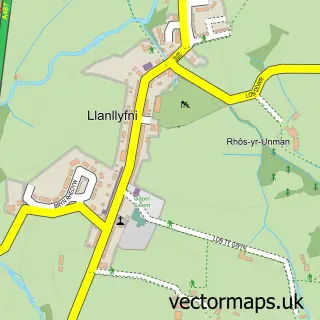
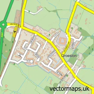
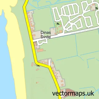
This Pen-y-groes street map is a detailed vector street map covering a 750m x 750m area. Select a larger area to create and download your own vector street map of Pen-y-groes.
The 750-metre map sample for Pen-y-groes covers 339 mapped buildings and approximately 14.7 km of road detail, of which 30 named roads are named. The immediate area includes 3 schools, 1 GP surgery, 1 pub and 2 MOT stations, with 3 within 2 miles. The wider area around Pen-y-groes features 4 food and drink venues and 1 hotel. To create a larger or custom map of Pen-y-groes, the map builder lets you define your own coverage area and download editable SVG, PDF and PNG files.
Create a larger editable map of Pen-y-groes
Choose any area you need and generate a high-quality vector map instantly. Perfect for print, planning, design, business and personal use.

This Pen-y-groes street map in Gwynedd is available as downloadable SVG, PDF and PNG map files, or as a printed map for planning, business, display, education, local information and design work. You can also create a larger custom map area using the map selector.
What this Pen-y-groes map sample shows
Pen-y-groes lies within Llanllyfni Community parish, part of Penygroes ward in the Gwynedd - Gwynedd local authority area. The postcode geography for this area includes the LL postcode area, the LL54 postcode district and the LL54 6 postcode sector. Residents fall under the Betsi Cadwaladr University Health Board for NHS services.
Local features near Pen-y-groes
Within 2 milesAmenities and services in and around Pen-y-groes.
Administrative and postcode information for Pen-y-groes
Pen-y-groes lies within Llanllyfni Community parish, part of Penygroes ward in the Gwynedd - Gwynedd local authority area. The postcode geography for this area includes the LL postcode area, the LL54 postcode district and the LL54 6 postcode sector. Residents fall under the Betsi Cadwaladr University Health Board for NHS services.
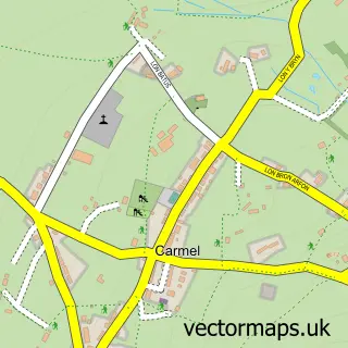
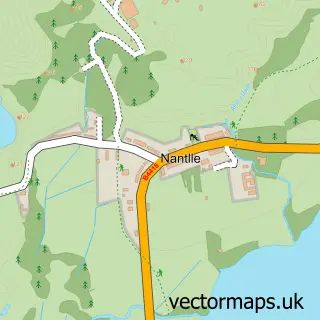
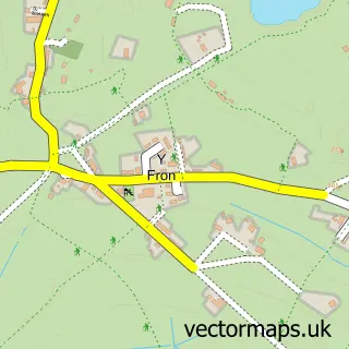
Nearby street map samples around Pen-y-groes

More street maps in Gwynedd
750 metre map area coverage
Boundary, postcode and point of interest information for the 750m x 750m rectangle centred on this sample map.
Boundaries containing map centre
Constituency: Dwyfor Meirionnydd Co Const
District: Gwynedd - Gwynedd
Icb: Betsi Cadwaladr University
Parish: Llanllyfni Community
Police Force: north wales
Postcode District: LL54
Postcode Sector: LL54 6
Nearby boundaries intersecting sample
No additional intersecting boundaries found.
Postcode coverage
POI category counts
Convenience Store: 4
Automotive Repair: 2
Chinese Restaurant: 2
Coffee Shop: 2
Cottage: 2
Hair Salon: 2
High School: 2
It Service And Computer Repair: 2
Shipping Center: 2
Agriculture: 1
Sample points of interest
- Wynnstay Stores
- Drws-y-Coed Boarding Kennels
- Ludicrous Allsorts
- Oriel Llun Mewn Ffram
- The Cooperative Food Pen Y Groes
- Moduron H G Jones Motors
- Povey's
- Homestyle Bakery
- HSBC Bank
- Harddwch gan Lowri Mai
- Gwynedd House Clearance
- Yr Orsaf
Create a larger editable map of Pen-y-groes
This sample shows only a 750 metre area. To create a larger map of Pen-y-groes, use our map builder to choose your own coverage area, add titles and download editable SVG, PDF and PNG files.
Create a custom map of Pen-y-groes