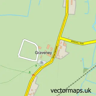
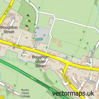
This Yorkletts street map is a detailed vector street map covering a 750m x 750m area. Select a larger area to create and download your own vector street map of Yorkletts.
The 750-metre map sample for Yorkletts covers 136 mapped buildings and approximately 5.9 km of road detail, of which 6 named roads are named. The immediate area includes 1 GP surgery within 2 miles and 2 MOT stations within 2 miles. The wider area around Yorkletts features 2 food and drink venues and 1 campsite within 2 miles. To create a larger or custom map of Yorkletts, the map builder lets you define your own coverage area and download editable SVG, PDF and PNG files.
Create a larger editable map of Yorkletts
Choose any area you need and generate a high-quality vector map instantly. Perfect for print, planning, design, business and personal use.

This Yorkletts street map in Kent is available as downloadable SVG, PDF and PNG map files, or as a printed map for planning, business, display, education, local information and design work. You can also create a larger custom map area using the map selector.
What this Yorkletts map sample shows
Yorkletts lies within Kent County parish, part of Seasalter ward in the Canterbury District (B) local authority area. The postcode geography for this area includes the CT postcode area, the CT5 postcode district and the CT5 3 postcode sector. Residents fall under the Nhs Kent And Medway Integrated Care Board for NHS services.
Local features near Yorkletts
Within 2 milesAmenities and services in and around Yorkletts.
Administrative and postcode information for Yorkletts
The local authority covering Yorkletts is Canterbury District (B), within the county of Kent. The settlement lies within Seasalter ward and Kent County civil parish. The CT5 postcode district and CT5 3 postcode sector serve the immediate area. NHS provision in the area is delivered through East Kent Hospitals University Nhs Foundation Trust.
Nearby street map samples around Yorkletts

More street maps in Kent
750 metre map area coverage
Boundary, postcode and point of interest information for the 750m x 750m rectangle centred on this sample map.
Boundaries containing map centre
Constituency: Canterbury Co Const
County: Kent County
District: Canterbury District (B)
Icb: NHS Kent and Medway ICB
Police Force: kent
Postcode District: CT5
Postcode Sector: CT5 3
Ward: Seasalter Ward
Nearby boundaries intersecting sample
Constituency: Faversham and Mid Kent Co Const
District: Swale District (B)
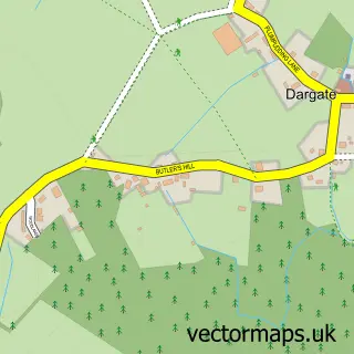
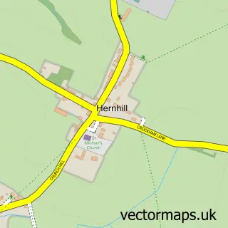
Parish: Hernhill CP
Postcode District: ME13
Postcode Sector: CT5 4, ME13 9
Ward: Boughton and Courtenay Ward
Postcode coverage
POI category counts
Coffee Shop: 2
Airport Terminal: 1
Dog Trainer: 1
Driving School: 1
Freight And Cargo Service: 1
Home And Garden: 1
It Service And Computer Repair: 1
Nature Reserve: 1
Pest Control Service: 1
Pet Boarding: 1
Sample points of interest
- Gatwick Airport South Terminal
- Costa Coffee
- Thanet Way
- Jenkins Canine Services
- Invicta Motorcycle Training
- Howe Logistics
- Unique home and garden
- Brooklyn Systems
- Victory Wood
- Bowman Pest Control & Bird Proofing
- Kopperkins Boarding Cattery
- Kopperkins Boarding Cattery
Create a larger editable map of Yorkletts
This sample shows only a 750 metre area. To create a larger map of Yorkletts, use our map builder to choose your own coverage area, add titles and download editable SVG, PDF and PNG files.
Create a custom map of Yorkletts