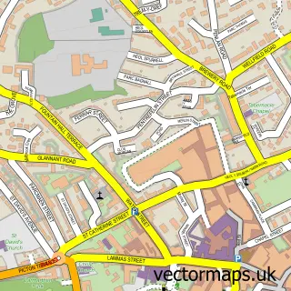
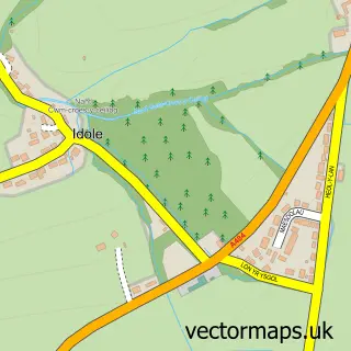
This Abergwili street map is a detailed vector street map covering a 750m x 750m area. Select a larger area to create and download your own vector street map of Abergwili.
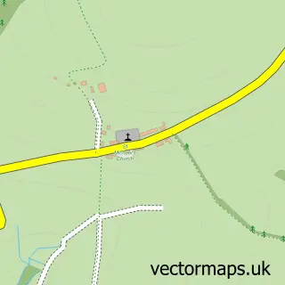
The 750-metre map sample for Abergwili covers 113 mapped buildings and approximately 8.3 km of road detail, of which 11 named roads are named. The immediate area includes 1 school, 2 pubs and 5 MOT stations within 2 miles. The wider area around Abergwili features 1 tourism point of interest and 2 food and drink venues. To create a larger or custom map of Abergwili, the map builder lets you define your own coverage area and download editable SVG, PDF and PNG files.
Create a larger editable map of Abergwili
Choose any area you need and generate a high-quality vector map instantly. Perfect for print, planning, design, business and personal use.

This Abergwili street map in Dyfed is available as downloadable SVG, PDF and PNG map files, or as a printed map for planning, business, display, education, local information and design work. You can also create a larger custom map area using the map selector.
What this Abergwili map sample shows
Abergwili lies within Abergwili Community parish, part of Abergwili ward in the Sir Gaerfyrddin - Carmarthenshire local authority area. The postcode geography for this area includes the SA postcode area, the SA31 postcode district and the SA31 2 postcode sector. Residents fall under the Hywel Dda University Health Board for NHS services.
Local features near Abergwili
Within 2 milesAmenities and services in and around Abergwili.
Administrative and postcode information for Abergwili
Abergwili lies within Abergwili Community parish, part of Abergwili ward in the Sir Gaerfyrddin - Carmarthenshire local authority area. The postcode geography for this area includes the SA postcode area, the SA31 postcode district and the SA31 2 postcode sector. Residents fall under the Hywel Dda University Health Board for NHS services.
Nearby street map samples around Abergwili

More street maps in Dyfed
750 metre map area coverage
Boundary, postcode and point of interest information for the 750m x 750m rectangle centred on this sample map.
Boundaries containing map centre
Constituency: Caerfyrddin Co Const
District: Sir Gaerfyrddin - Carmarthenshire
Icb: Hywel Dda
Parish: Abergwili Community
Police Force: dyfed-powys
Postcode District: SA31
Postcode Sector: SA31 2
Nearby boundaries intersecting sample
Parish: Carmarthen Community
Postcode coverage
POI category counts
Pub: 2
Church Cathedral: 1
Community Center: 1
Day Care Preschool: 1
Education: 1
Elementary School: 1
Gastropub: 1
Landmark And Historical Building: 1
Playground: 1
Post Office: 1
Sample points of interest
- Bishop of St Davids
- Abergwili Recreation Club
- Cylch Meithrin Abergwili
- Abergwili Voluntary Controlled County Primary School
- Ysgol Wirfoddol Abergwili
- The Black Ox Abergwili
- Carmarthen Centre
- Abergwili Play Park
- Abergwili Mobile Service Post Office
- Black Ox
- Wheaten Sheaf
Create a larger editable map of Abergwili
This sample shows only a 750 metre area. To create a larger map of Abergwili, use our map builder to choose your own coverage area, add titles and download editable SVG, PDF and PNG files.
Create a custom map of Abergwili