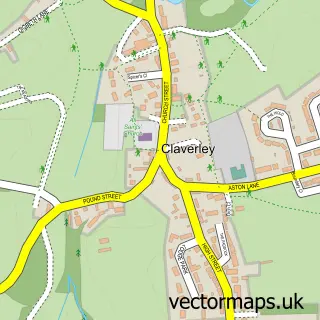
This Ackleton street map is a detailed vector street map covering a 750m x 750m area. Select a larger area to create and download your own vector street map of Ackleton.
The 750-metre map sample for Ackleton covers 120 mapped buildings and approximately 22.0 km of road detail, of which 5 named roads are named. The immediate area includes 1 pub. The wider area around Ackleton features 1 food and drink venue. To create a larger or custom map of Ackleton, the map builder lets you define your own coverage area and download editable SVG, PDF and PNG files.
Create a larger editable map of Ackleton
Choose any area you need and generate a high-quality vector map instantly. Perfect for print, planning, design, business and personal use.

This Ackleton street map in Shropshire is available as downloadable SVG, PDF and PNG map files, or as a printed map for planning, business, display, education, local information and design work. You can also create a larger custom map area using the map selector.
What this Ackleton map sample shows
Ackleton lies within Worfield Cp parish, part of Worfield ward in the Shropshire local authority area. The postcode geography for this area includes the WV postcode area, the WV6 postcode district and the WV6 7 postcode sector. Residents fall under the Nhs Shropshire, Telford And Wrekin Integrated Care Board for NHS services.
Local features near Ackleton
Within 2 milesAmenities and services in and around Ackleton.
Administrative and postcode information for Ackleton
The local authority covering Ackleton is Shropshire, within the county of Shropshire. The settlement lies within Worfield ward and Worfield Cp civil parish. The WV6 postcode district and WV6 7 postcode sector serve the immediate area. NHS provision in the area is delivered through The Shrewsbury And Telford Hospital Nhs Trust.
Nearby street map samples around Ackleton

More street maps in Shropshire
750 metre map area coverage
Boundary, postcode and point of interest information for the 750m x 750m rectangle centred on this sample map.
Boundaries containing map centre
Constituency: South Shropshire Co Const
District: Shropshire
Icb: NHS Shropshire Telford and Wrekin ICB
Parish: Worfield CP
Police Force: west mercia
Postcode District: WV6
Postcode Sector: WV6 7
Nearby boundaries intersecting sample
Postcode District: WV15
Postcode Sector: WV15 5
Postcode coverage
POI category counts
Business Office Supplies And Stationery: 1
Employment Agencies: 1
Farm: 1
Fitness Trainer: 1
Food Beverage Service Distribution: 1
Freight And Cargo Service: 1
Motorcycle Repair: 1
Pub: 1
Sample points of interest
- The Inkdrop
- Partners 4 Sucess
- Adventures at Annie's Farm
- Lauren May Fitness
- Waltons Cafe Express
- P & G Marsh
- Parallel Engineering
- The Red Cow Inn
Create a larger editable map of Ackleton
This sample shows only a 750 metre area. To create a larger map of Ackleton, use our map builder to choose your own coverage area, add titles and download editable SVG, PDF and PNG files.
Create a custom map of Ackleton