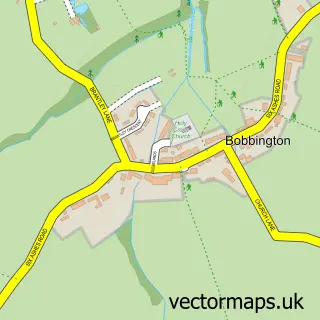
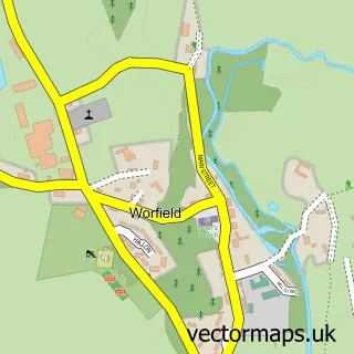
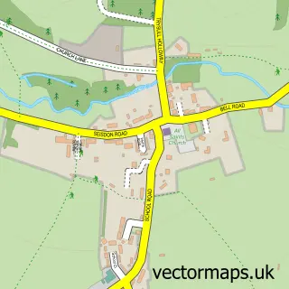
This Claverley street map is a detailed vector street map covering a 750m x 750m area. Select a larger area to create and download your own vector street map of Claverley.
The 750-metre map sample for Claverley covers 181 mapped buildings and approximately 30.5 km of road detail, of which 12 named roads are named. The immediate area includes 1 school, 1 GP surgery and 3 pubs. The wider area around Claverley features 3 food and drink venues. To create a larger or custom map of Claverley, the map builder lets you define your own coverage area and download editable SVG, PDF and PNG files.
Create a larger editable map of Claverley
Choose any area you need and generate a high-quality vector map instantly. Perfect for print, planning, design, business and personal use.

This Claverley street map in Shropshire is available as downloadable SVG, PDF and PNG map files, or as a printed map for planning, business, display, education, local information and design work. You can also create a larger custom map area using the map selector.
What this Claverley map sample shows
Claverley lies within Claverley Cp parish, part of Alveley And Claverley ward in the Shropshire local authority area. The postcode geography for this area includes the WV postcode area, the WV5 postcode district and the WV5 7 postcode sector. Residents fall under the Nhs Shropshire, Telford And Wrekin Integrated Care Board for NHS services.
Local features near Claverley
Within 2 milesAmenities and services in and around Claverley.
Administrative and postcode information for Claverley
The local authority covering Claverley is Shropshire, within the county of Shropshire. The settlement lies within Alveley And Claverley ward and Claverley Cp civil parish. The WV5 postcode district and WV5 7 postcode sector serve the immediate area. NHS provision in the area is delivered through The Shrewsbury And Telford Hospital Nhs Trust.
Nearby street map samples around Claverley

More street maps in Shropshire
750 metre map area coverage
Boundary, postcode and point of interest information for the 750m x 750m rectangle centred on this sample map.
Boundaries containing map centre
Constituency: South Shropshire Co Const
District: Shropshire
Icb: NHS Shropshire Telford and Wrekin ICB
Parish: Claverley CP
Police Force: west mercia
Postcode District: WV5
Postcode Sector: WV5 7
Nearby boundaries intersecting sample
No additional intersecting boundaries found.
Postcode coverage
POI category counts
Pub: 3
Shipping Center: 3
Auto Loan Provider: 2
Anglican Church: 1
Beauty And Spa: 1
Car Dealer: 1
Church Cathedral: 1
Contractor: 1
Doctor: 1
Driving School: 1
Sample points of interest
- Claverley: All Saints
- Stone Castle Associates
- Turner, a
- The Brow Lounge by Ali
- TCS Cars
- All Saints Church
- C J Noakes Plastering Contractor
- Claverley
- Cartwright's Driving School
- Claverley CofE Primary School
- Claverley Medical Practice
- Little Woodlings Nursery
Create a larger editable map of Claverley
This sample shows only a 750 metre area. To create a larger map of Claverley, use our map builder to choose your own coverage area, add titles and download editable SVG, PDF and PNG files.
Create a custom map of Claverley