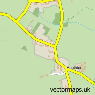
This Trysull street map is a detailed vector street map covering a 750m x 750m area. Select a larger area to create and download your own vector street map of Trysull.
The 750-metre map sample for Trysull covers 104 mapped buildings and approximately 29.2 km of road detail, of which 9 named roads are named. The immediate area includes 1 school, 2 GP surgeries within 2 miles, 1 pub and 4 MOT stations within 2 miles. The wider area around Trysull features 1 food and drink venue. To create a larger or custom map of Trysull, the map builder lets you define your own coverage area and download editable SVG, PDF and PNG files.
Create a larger editable map of Trysull
Choose any area you need and generate a high-quality vector map instantly. Perfect for print, planning, design, business and personal use.

This Trysull street map in Staffordshire is available as downloadable SVG, PDF and PNG map files, or as a printed map for planning, business, display, education, local information and design work. You can also create a larger custom map area using the map selector.
What this Trysull map sample shows
Trysull lies within Trysull And Seisdon Cp parish, part of Trysull And Seisdon ward in the South Staffordshire District local authority area. The postcode geography for this area includes the WV postcode area, the WV5 postcode district and the WV5 7 postcode sector. Residents fall under the Nhs Staffordshire And Stoke-On-Trent Integrated Care Board for NHS services.
Local features near Trysull
Within 2 milesAmenities and services in and around Trysull.
Administrative and postcode information for Trysull
Trysull lies within Trysull And Seisdon Cp parish, part of Trysull And Seisdon ward in the South Staffordshire District local authority area. The postcode geography for this area includes the WV postcode area, the WV5 postcode district and the WV5 7 postcode sector. Residents fall under the Nhs Staffordshire And Stoke-On-Trent Integrated Care Board for NHS services.
Nearby street map samples around Trysull

More street maps in Staffordshire
750 metre map area coverage
Boundary, postcode and point of interest information for the 750m x 750m rectangle centred on this sample map.
Boundaries containing map centre
Constituency: Kingswinford and South Staffordshire Co Const
County: Staffordshire County
District: South Staffordshire District
Icb: NHS Black Country ICB
Parish: Trysull and Seisdon CP
Police Force: staffordshire
Postcode District: WV5
Postcode Sector: WV5 7
Ward: Pattingham, Trysull, Bobbington & Lower Penn Ward
Nearby boundaries intersecting sample
No additional intersecting boundaries found.
Postcode coverage
POI category counts
Anglican Church: 1
Beer Bar: 1
Church Cathedral: 1
Community Services Non Profits: 1
Elementary School: 1
Hvac Services: 1
Hvac Supplier: 1
Language School: 1
Photography Store And Services: 1
Pub: 1
Sample points of interest
- Trysull All Saints
- The Plough Inn
- All Saints Church
- Trysull Tots Playgroup
- All Saints C of E Primary School
- Compsons
- Compsons Ltd. - Central Heating And Plumbing Services
- La Jolie Ronde Languages for Children
- Simon Bruntnell Photography
- The Bell Inn
Create a larger editable map of Trysull
This sample shows only a 750 metre area. To create a larger map of Trysull, use our map builder to choose your own coverage area, add titles and download editable SVG, PDF and PNG files.
Create a custom map of Trysull