Vector Maps logo
Home Why it works Popular maps Districts Samples Customizer Create Your Map
VectorMaps.uk
Home Popular maps Districts Samples Customizer Create Your Map Privacy Disclaimer
Home / UK Maps / West Midlands / Coseley Map

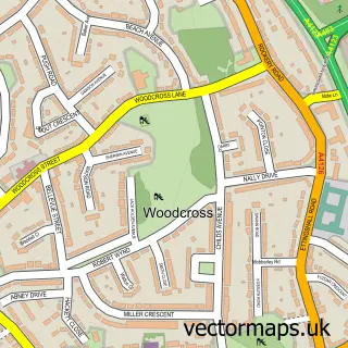
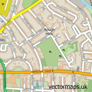
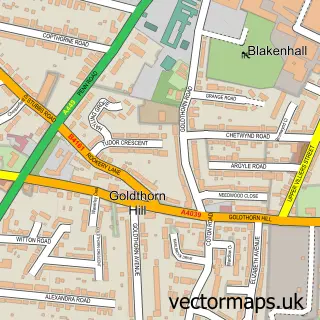
This Coseley street map is a detailed vector street map covering a 750m x 750m area. Select a larger area to create and download your own vector street map of Coseley.

Coseley is a town in West Midlands, in the West Midlands of England. Historically, the area formed part of Staffordshire. The settlement falls within the Wolverhampton South East parliamentary constituency. It is served by the WV14 postcode district, with

The 750-metre map sample for Coseley covers 354 mapped buildings and approximately 55.3 km of road detail, of which 43 named roads are named. The immediate area includes 1 school, 1 railway station, 1 GP surgery, with 15 within 2 miles and 5 pubs among other local services. The wider area around Coseley features 1 tourism point of interest and 6 food and drink venues. To create a larger or custom map of Coseley, the map builder lets you define your own coverage area and download editable SVG, PDF and PNG files.

354Buildings
55.33 kmRoads
43Named roads
51,898Residents within 2 miles
Create your own

Create a larger editable map of Coseley

Choose any area you need and generate a high-quality vector map instantly. Perfect for print, planning, design, business and personal use.

Choose any location
Editable SVG files
Any size up to A0
PDF, PNG & more
Instant download
High quality guaranteed
Create My Custom Map
Secure, private & no credit card required
Coseley Vector Street Map
750m Sample
Coseley vector street map sample showing roads, buildings and local features in a 750 metre preview area
Buy Coseley Map Print from £12.95 Buy Coseley Digital Map from £6

This Coseley street map in West Midlands is available as downloadable SVG, PDF and PNG map files, or as a printed map for planning, business, display, education, local information and design work. You can also create a larger custom map area using the map selector.

What this Coseley map sample shows

Coseley lies within Dudley District (B) parish, part of Coseley East ward in the Dudley District (B) local authority area. The postcode geography for this area includes the WV postcode area, the WV14 postcode district and the WV14 9 postcode sector. Residents fall under the Nhs Black Country Integrated Care Board for NHS services.

Local features near Coseley

Within 2 miles

Amenities and services in and around Coseley.

1 Schools
1 Railway stations
1 GP surgeries 15 within 2 miles
32 MOT stations within 2 miles
1 Tourism & leisure
6 Food & drink
5 Pubs
1 Healthcare POIs
4 Vehicle services

Counts are approximate and based on publicly available data.

Administrative and postcode information for Coseley

The local authority covering Coseley is Dudley District (B), within the county of West Midlands. The settlement lies within Coseley East ward and Dudley District (B) civil parish. The WV14 postcode district and WV14 9 postcode sector serve the immediate area. NHS provision in the area is delivered through The Dudley Group Nhs Foundation Trust.

Parish DUDLEY DISTRICT (B)
Ward Coseley East
District / local authority Dudley District (B)
County West Midlands
Historic county Staffordshire
Postcode district WV14
Postcode sector WV14 9
Parliamentary constituency Wolverhampton South East
Region West Midlands
Country England

Nearby street map samples around Coseley

Street map sample of Wolverhampton, West Midlands Wolverhampton City - West Midlands - 3.3 miles Street map sample of Woodcross, West Midlands Woodcross Village - West Midlands - 0.7 miles Street map sample of Ettingshall Park, West Midlands Ettingshall Park Village - West Midlands - 1.4 miles Street map sample of Ettingshall, West Midlands Ettingshall Village - West Midlands - 1.5 miles Street map sample of Parkfield, West Midlands Parkfield Village - West Midlands - 1.8 miles Street map sample of Rough Hills, West Midlands Rough Hills Village - West Midlands - 2.0 miles Street map sample of Goldthorn Park, West Midlands Goldthorn Park Village - West Midlands - 2.3 miles Street map sample of Kates Hill, West Midlands Kates Hill Village - West Midlands - 2.5 miles Street map sample of Gospel End, Staffordshire Gospel End Village - Staffordshire - 2.5 miles Street map sample of Goldthorn Hill, West Midlands Goldthorn Hill Village - West Midlands - 2.7 miles

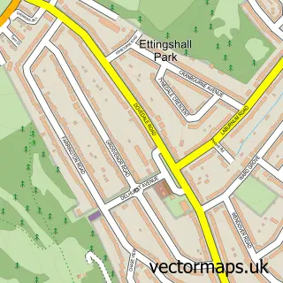
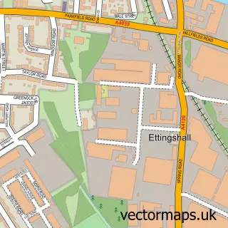
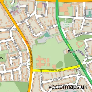
More street maps in West Midlands

Street map sample of Woodcross, West Midlands Woodcross Village - 0.7 miles Street map sample of Tipton, West Midlands Tipton Town - 1.3 miles Street map sample of Ettingshall Park, West Midlands Ettingshall Park Village - 1.4 miles Street map sample of Ettingshall, West Midlands Ettingshall Village - 1.5 miles Street map sample of Bilston, West Midlands Bilston Town - 1.8 miles

750 metre map area coverage

Boundary, postcode and point of interest information for the 750m x 750m rectangle centred on this sample map.

Boundaries containing map centre

Constituency: Tipton and Wednesbury Boro Const

District: Dudley District (B)

Icb: NHS Black Country ICB

Police Force: west midlands

Postcode District: WV14

Postcode Sector: WV14 9

Ward: Coseley Ward

Nearby boundaries intersecting sample

Postcode Sector: WV14 8

Postcode coverage

WV14 WV14 9 WV14 8

POI category counts

Pub: 5

Hair Salon: 4

Building Supply Store: 3

Fast Food Restaurant: 3

Gas Station: 3

Atms: 2

Barber: 2

Chinese Restaurant: 2

Convenience Store: 2

Desserts: 2

Sample points of interest

  • Compton Hospice shop Antique Store
  • Bridge House Assisted Living Facility
  • Barclays Bank Cash Machine Atms
  • PayPoint Atms
  • Power Steering Online Auto Restoration Services
  • Kestrel Service & Repair Centre Automotive Repair
  • Greggs Bakery
  • Tipton & Coseley Building Society Bank Credit Union
  • New Hope Baptist Church Baptist Church
  • Barber Stop Barber
  • Beau Barbers Barber
  • The Hair Studio by Rebecca Beauty And Spa

Create a larger editable map of Coseley

This sample shows only a 750 metre area. To create a larger map of Coseley, use our map builder to choose your own coverage area, add titles and download editable SVG, PDF and PNG files.

Create a custom map of Coseley

Phone 01751 473136 | Copyright Vectormaps.uk 2026

Samples Customizer Privacy Disclaimer
Coseley Vector Street Map
Coseley enlarged street map sample showing a 750 metre preview area