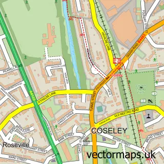
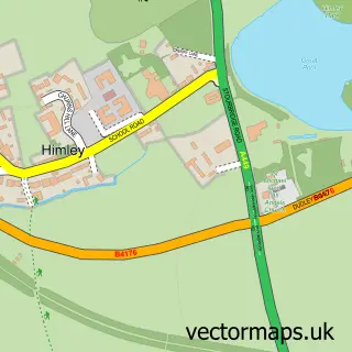
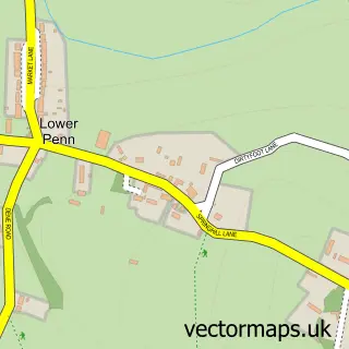
This Gospel End street map is a detailed vector street map covering a 750m x 750m area. Select a larger area to create and download your own vector street map of Gospel End.
The 750-metre map sample for Gospel End covers 129 mapped buildings and approximately 27.1 km of road detail, of which 9 named roads are named. The immediate area includes 8 GP surgeries within 2 miles, 2 pubs and 7 MOT stations within 2 miles. The wider area around Gospel End features 2 food and drink venues. To create a larger or custom map of Gospel End, the map builder lets you define your own coverage area and download editable SVG, PDF and PNG files.
Create a larger editable map of Gospel End
Choose any area you need and generate a high-quality vector map instantly. Perfect for print, planning, design, business and personal use.

This Gospel End street map in Staffordshire is available as downloadable SVG, PDF and PNG map files, or as a printed map for planning, business, display, education, local information and design work. You can also create a larger custom map area using the map selector.
What this Gospel End map sample shows
Gospel End lies within Dudley District (B) parish, part of Sedgley ward in the Dudley District (B) local authority area. The postcode geography for this area includes the DY postcode area, the DY3 postcode district and the DY3 1 postcode sector. Residents fall under the Nhs Black Country Integrated Care Board for NHS services.
Local features near Gospel End
Within 2 milesAmenities and services in and around Gospel End.
Administrative and postcode information for Gospel End
Gospel End lies within Dudley District (B) parish, part of Sedgley ward in the Dudley District (B) local authority area. The postcode geography for this area includes the DY postcode area, the DY3 postcode district and the DY3 1 postcode sector. Residents fall under the Nhs Black Country Integrated Care Board for NHS services.
Nearby street map samples around Gospel End

More street maps in Staffordshire
750 metre map area coverage
Boundary, postcode and point of interest information for the 750m x 750m rectangle centred on this sample map.
Boundaries containing map centre
Constituency: Kingswinford and South Staffordshire Co Const
County: Staffordshire County
District: South Staffordshire District
Icb: NHS Black Country ICB
Parish: Himley CP
Police Force: staffordshire
Postcode District: DY3
Postcode Sector: DY3 4
Ward: Himley & Swindon Ward
Nearby boundaries intersecting sample
No additional intersecting boundaries found.
Postcode coverage
POI category counts
Pub: 2
Home Service: 1
Massage Therapy: 1
Medical Center: 1
Retirement Home: 1
Sample points of interest
- The Wildlings Outdoor School
- Star Sports Massage
- West Midlands Ambulance Service Nhs Trust
- Summerhouse
- The Summerhouse, Sedgley
- The Firs Care Home
Create a larger editable map of Gospel End
This sample shows only a 750 metre area. To create a larger map of Gospel End, use our map builder to choose your own coverage area, add titles and download editable SVG, PDF and PNG files.
Create a custom map of Gospel End