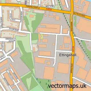
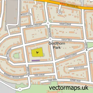
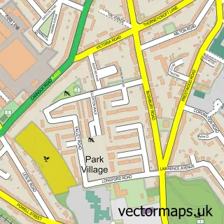
This Ettingshall Park street map is a detailed vector street map covering a 750m x 750m area. Select a larger area to create and download your own vector street map of Ettingshall Park.
The 750-metre map sample for Ettingshall Park covers 340 mapped buildings and approximately 42.8 km of road detail, of which 22 named roads are named. The immediate area includes 1 school, 15 GP surgeries within 2 miles, 2 pubs and 53 MOT stations within 2 miles. The wider area around Ettingshall Park features 2 tourism points of interest and 2 food and drink venues. To create a larger or custom map of Ettingshall Park, the map builder lets you define your own coverage area and download editable SVG, PDF and PNG files.
Create a larger editable map of Ettingshall Park
Choose any area you need and generate a high-quality vector map instantly. Perfect for print, planning, design, business and personal use.

This Ettingshall Park street map in West Midlands is available as downloadable SVG, PDF and PNG map files, or as a printed map for planning, business, display, education, local information and design work. You can also create a larger custom map area using the map selector.
What this Ettingshall Park map sample shows
Ettingshall Park lies within Dudley District (B) parish, part of Sedgley ward in the Dudley District (B) local authority area. The postcode geography for this area includes the DY postcode area, the DY3 postcode district and the DY3 1 postcode sector. Residents fall under the Nhs Black Country Integrated Care Board for NHS services.
Local features near Ettingshall Park
Within 2 milesAmenities and services in and around Ettingshall Park.
Administrative and postcode information for Ettingshall Park
The local authority covering Ettingshall Park is Dudley District (B), within the county of West Midlands. The settlement lies within Sedgley ward and Dudley District (B) civil parish. The DY3 postcode district and DY3 1 postcode sector serve the immediate area. NHS provision in the area is delivered through The Dudley Group Nhs Foundation Trust.
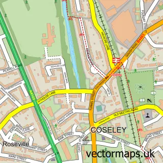
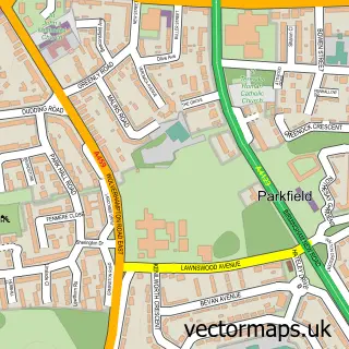
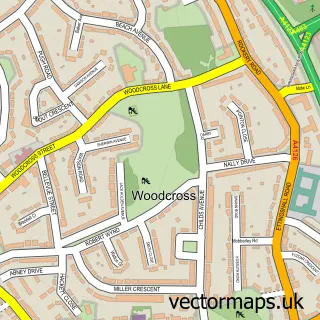
Nearby street map samples around Ettingshall Park

More street maps in West Midlands
750 metre map area coverage
Boundary, postcode and point of interest information for the 750m x 750m rectangle centred on this sample map.
Boundaries containing map centre
Constituency: Wolverhampton South East Boro Const
District: City of Wolverhampton District (B)
Icb: NHS Black Country ICB
Police Force: west midlands
Postcode District: WV4
Postcode Sector: WV4 6
Ward: Ettingshall South & Spring Vale Ward
Nearby boundaries intersecting sample
Constituency: Dudley Boro Const, Wolverhampton West Boro Const
District: Dudley District (B)
Postcode District: DY3
Postcode Sector: DY3 1
Ward: Blakenhall Ward, Sedgley Ward
Postcode coverage
POI category counts
Post Office: 4
Anglican Church: 2
Beauty And Spa: 2
Hair Salon: 2
Pub: 2
Security Services: 2
Advertising Agency: 1
Balloon Services: 1
Bar: 1
Beauty Salon: 1
Sample points of interest
- Digital D
- Holy Trinity Church
- Holy Trinity Ettingshall
- Choice Balloons
- The Charlton Arms
- Golden Touch Barber
- Hair by Sam at Salon 81
- Krisu
- 1st Ettingshall Scout Group
- Holy Trinity C of E Church
- Post Office Travel Money
- Sean Robert Lowe
Create a larger editable map of Ettingshall Park
This sample shows only a 750 metre area. To create a larger map of Ettingshall Park, use our map builder to choose your own coverage area, add titles and download editable SVG, PDF and PNG files.
Create a custom map of Ettingshall Park