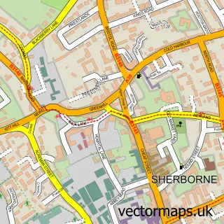
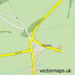
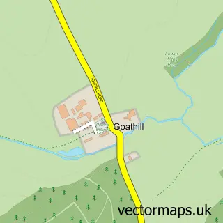
This Alweston street map is a detailed vector street map covering a 750m x 750m area. Select a larger area to create and download your own vector street map of Alweston.
The 750-metre map sample for Alweston covers 94 mapped buildings and approximately 11.0 km of road detail, of which 7 named roads are named. The immediate area includes 1 GP surgery within 2 miles and 3 MOT stations within 2 miles. The wider area around Alweston features 1 food and drink venue. To create a larger or custom map of Alweston, the map builder lets you define your own coverage area and download editable SVG, PDF and PNG files.
Create a larger editable map of Alweston
Choose any area you need and generate a high-quality vector map instantly. Perfect for print, planning, design, business and personal use.

This Alweston street map in Dorset is available as downloadable SVG, PDF and PNG map files, or as a printed map for planning, business, display, education, local information and design work. You can also create a larger custom map area using the map selector.
What this Alweston map sample shows
Alweston lies within Folke Cp parish, part of Sherborne Rural ward in the Dorset local authority area. The postcode geography for this area includes the DT postcode area, the DT9 postcode district and the DT9 5 postcode sector. Residents fall under the Nhs Dorset Integrated Care Board for NHS services.
Local features near Alweston
Within 2 milesAmenities and services in and around Alweston.
Administrative and postcode information for Alweston
The local authority covering Alweston is Dorset, within the county of Dorset. The settlement lies within Sherborne Rural ward and Folke Cp civil parish. The DT9 postcode district and DT9 5 postcode sector serve the immediate area. NHS provision in the area is delivered through Yeovil District Hospital Nhs Foundation Trust.
Nearby street map samples around Alweston

More street maps in Dorset
750 metre map area coverage
Boundary, postcode and point of interest information for the 750m x 750m rectangle centred on this sample map.
Boundaries containing map centre
Constituency: West Dorset Co Const
District: Dorset
Icb: NHS Dorset ICB
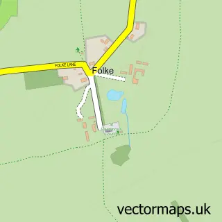
Parish: Folke CP
Police Force: dorset
Postcode District: DT9
Postcode Sector: DT9 5
Ward: Sherborne Rural Ward
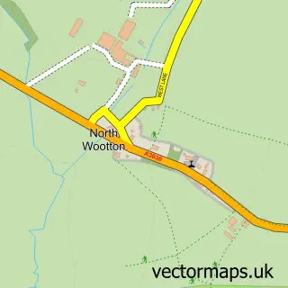
Nearby boundaries intersecting sample
Parish: North Wootton CP
Postcode coverage
POI category counts
Bed And Breakfast: 2
Audiovisual Equipment Rental: 1
Bakery: 1
Golf Course: 1
It Service And Computer Repair: 1
Naturopathic Holistic: 1
Pop Up Shop: 1
Post Office: 1
Restaurant: 1
Sample points of interest
- F Cuff & Sons
- Oxfords Bakery
- Munden House
- Munden House Ltd.
- Folke Golf Centre
- Joseph Crocker Computers
- Firestar Therapies
- Folke Christmas Trees
- Alweston Post Office
- 4 Seasons at Folke
Create a larger editable map of Alweston
This sample shows only a 750 metre area. To create a larger map of Alweston, use our map builder to choose your own coverage area, add titles and download editable SVG, PDF and PNG files.
Create a custom map of Alweston