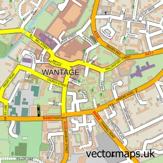
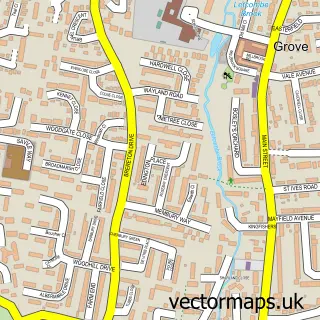
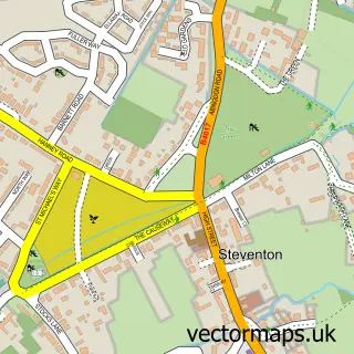
This Ardington street map is a detailed vector street map covering a 750m x 750m area. Select a larger area to create and download your own vector street map of Ardington.
The 750-metre map sample for Ardington covers 108 mapped buildings and approximately 8.0 km of road detail, of which 7 named roads are named. The immediate area includes 1 pub and 4 MOT stations within 2 miles. The wider area around Ardington features 3 food and drink venues. To create a larger or custom map of Ardington, the map builder lets you define your own coverage area and download editable SVG, PDF and PNG files.
Create a larger editable map of Ardington
Choose any area you need and generate a high-quality vector map instantly. Perfect for print, planning, design, business and personal use.

This Ardington street map in Oxfordshire is available as downloadable SVG, PDF and PNG map files, or as a printed map for planning, business, display, education, local information and design work. You can also create a larger custom map area using the map selector.
What this Ardington map sample shows
Ardington lies within Ardington Cp parish, part of Hendreds ward in the Vale Of White Horse District local authority area. The postcode geography for this area includes the OX postcode area, the OX12 postcode district and the OX12 8 postcode sector. Residents fall under the Nhs Buckinghamshire, Oxfordshire And Berkshire West Integrated Care Board for NHS services.
Local features near Ardington
Within 2 milesAmenities and services in and around Ardington.
Administrative and postcode information for Ardington
Ardington lies within Ardington Cp parish, part of Hendreds ward in the Vale Of White Horse District local authority area. The postcode geography for this area includes the OX postcode area, the OX12 postcode district and the OX12 8 postcode sector. Residents fall under the Nhs Buckinghamshire, Oxfordshire And Berkshire West Integrated Care Board for NHS services.
Nearby street map samples around Ardington

More street maps in Oxfordshire
750 metre map area coverage
Boundary, postcode and point of interest information for the 750m x 750m rectangle centred on this sample map.
Boundaries containing map centre
Constituency: Didcot and Wantage Co Const
County: Oxfordshire County
District: Vale of White Horse District
Icb: NHS Thames Valley ICB
Parish: Ardington CP
Police Force: thames valley
Postcode District: OX12
Postcode Sector: OX12 8
Ward: Hendreds Ward
Nearby boundaries intersecting sample
No additional intersecting boundaries found.
Postcode coverage
POI category counts
Advertising Agency: 5
Cafe: 2
Event Planning: 2
Preschool: 2
Anglican Church: 1
Auto Body Shop: 1
Bakery: 1
Beauty And Spa: 1
Building Supply Store: 1
Business Manufacturing And Supply: 1
Sample points of interest
- Ampersand Design
- B & M Design & Advertising
- B&M Design & Advertising Ltd.
- D N A Ltd.
- DNA
- Ardington: Holy Trinity
- Clever Dent Repair
- Ardington Bakery
- It's Sugar! Social
- Cameron Peters Fine Lighting
- Navtech Radar
- Sarah Morris
Create a larger editable map of Ardington
This sample shows only a 750 metre area. To create a larger map of Ardington, use our map builder to choose your own coverage area, add titles and download editable SVG, PDF and PNG files.
Create a custom map of Ardington