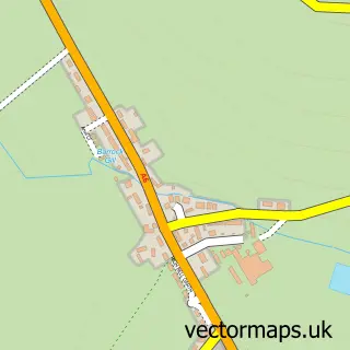
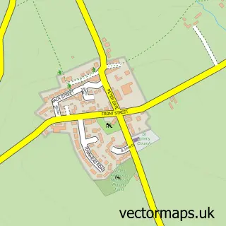
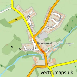
This Armathwaite street map is a detailed vector street map covering a 750m x 750m area. Select a larger area to create and download your own vector street map of Armathwaite.
The 750-metre map sample for Armathwaite covers 129 mapped buildings and approximately 12.7 km of road detail, of which 5 named roads are named. The immediate area includes 1 railway station and 2 pubs. The wider area around Armathwaite features 1 tourism point of interest, 2 food and drink venues and 4 hotels. To create a larger or custom map of Armathwaite, the map builder lets you define your own coverage area and download editable SVG, PDF and PNG files.
Create a larger editable map of Armathwaite
Choose any area you need and generate a high-quality vector map instantly. Perfect for print, planning, design, business and personal use.

This Armathwaite street map in Cumbria is available as downloadable SVG, PDF and PNG map files, or as a printed map for planning, business, display, education, local information and design work. You can also create a larger custom map area using the map selector.
What this Armathwaite map sample shows
Armathwaite lies within Hesket Cp parish, part of Hesket ward in the Westmorland And Furness local authority area. The postcode geography for this area includes the CA postcode area, the CA4 postcode district and the CA4 9 postcode sector. Residents fall under the Nhs North East And North Cumbria Integrated Care Board for NHS services.
Local features near Armathwaite
Within 2 milesAmenities and services in and around Armathwaite.
Administrative and postcode information for Armathwaite
Armathwaite lies within Hesket Cp parish, part of Hesket ward in the Westmorland And Furness local authority area. The postcode geography for this area includes the CA postcode area, the CA4 postcode district and the CA4 9 postcode sector. Residents fall under the Nhs North East And North Cumbria Integrated Care Board for NHS services.
Nearby street map samples around Armathwaite

More street maps in Cumbria
750 metre map area coverage
Boundary, postcode and point of interest information for the 750m x 750m rectangle centred on this sample map.
Boundaries containing map centre
Constituency: Penrith and Solway Co Const
District: Westmorland and Furness
Icb: NHS North East and North Cumbria ICB
Parish: Hesket CP
Police Force: cumbria
Postcode District: CA4
Postcode Sector: CA4 9
Ward: Hesket and Lazonby Ward
Nearby boundaries intersecting sample
Parish: Ainstable CP
Ward: Alston and Fellside Ward
Postcode coverage
POI category counts
Hotel: 4
Post Office: 3
Train Station: 3
Pub: 2
Public And Government Association: 2
Anglican Church: 1
Bed And Breakfast: 1
Boat Dealer: 1
Business: 1
Castle: 1
Sample points of interest
- Christ & St Mary
- Coombs View Holiday Cottages
- Rydal Ribs
- Freerange Industries
- Armathwaite Castle
- Armathwaite Old School Hall
- Eden Stores
- Eden Cottage
- Riverside Retreat at Low Flatts Armathwaite
- Eden Grove Cottage - Cumbria Holiday Cottage
- Fox & Pheasant
- The Fox & Pheasant Inn
Create a larger editable map of Armathwaite
This sample shows only a 750 metre area. To create a larger map of Armathwaite, use our map builder to choose your own coverage area, add titles and download editable SVG, PDF and PNG files.
Create a custom map of Armathwaite