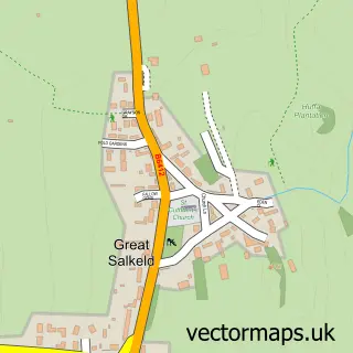
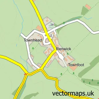
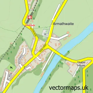
This Kirkoswald street map is a detailed vector street map covering a 750m x 750m area. Select a larger area to create and download your own vector street map of Kirkoswald.
The 750-metre map sample for Kirkoswald covers 129 mapped buildings and approximately 15.7 km of road detail, of which 6 named roads are named. The immediate area includes 1 school, 1 GP surgery, 2 pubs and 1 MOT station. The wider area around Kirkoswald features 2 food and drink venues, 1 hotel and 1 campsite within 2 miles. To create a larger or custom map of Kirkoswald, the map builder lets you define your own coverage area and download editable SVG, PDF and PNG files.
Create a larger editable map of Kirkoswald
Choose any area you need and generate a high-quality vector map instantly. Perfect for print, planning, design, business and personal use.

This Kirkoswald street map in Cumbria is available as downloadable SVG, PDF and PNG map files, or as a printed map for planning, business, display, education, local information and design work. You can also create a larger custom map area using the map selector.
What this Kirkoswald map sample shows
Kirkoswald lies within Kirkoswald Cp parish, part of Kirkoswald ward in the Westmorland And Furness local authority area. The postcode geography for this area includes the CA postcode area, the CA10 postcode district and the CA10 1 postcode sector. Residents fall under the Nhs North East And North Cumbria Integrated Care Board for NHS services.
Local features near Kirkoswald
Within 2 milesAmenities and services in and around Kirkoswald.
Administrative and postcode information for Kirkoswald
The local authority covering Kirkoswald is Westmorland And Furness, within the county of Cumbria. The settlement lies within Kirkoswald ward and Kirkoswald Cp civil parish. The CA10 postcode district and CA10 1 postcode sector serve the immediate area. NHS provision in the area is delivered through North Cumbria Integrated Care Nhs Foundation Trust.
Nearby street map samples around Kirkoswald

More street maps in Cumbria
750 metre map area coverage
Boundary, postcode and point of interest information for the 750m x 750m rectangle centred on this sample map.
Boundaries containing map centre
Constituency: Penrith and Solway Co Const
District: Westmorland and Furness
Icb: NHS North East and North Cumbria ICB
Parish: Kirkoswald CP
Police Force: cumbria
Postcode District: CA10
Postcode Sector: CA10 1
Ward: Alston and Fellside Ward
Nearby boundaries intersecting sample
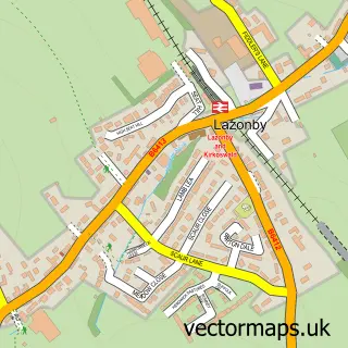
Parish: Lazonby CP
Postcode coverage
POI category counts
Education: 2
Post Office: 2
Pub: 2
Archery Shop: 1
Arts And Entertainment: 1
Auto Electrical Repair: 1
Business Manufacturing And Supply: 1
Community Center: 1
Cricket Ground: 1
Doctor: 1
Sample points of interest
- Pointy, Feathery, Sticks
- Pet Portraits by Sally Logue
- Stephen Taylor Pat Testing
- Garage Door Services Cumbria
- Kirkoswald Village Hall
- Staffield Cricket Club
- Kirkoswald Surgery
- John Jones Training & Assessment Services
- John Jones Training & Assessment Services
- Kirkoswald C Of E School
- The Franchise Team Ltd.
- Eden View Lazonby
Create a larger editable map of Kirkoswald
This sample shows only a 750 metre area. To create a larger map of Kirkoswald, use our map builder to choose your own coverage area, add titles and download editable SVG, PDF and PNG files.
Create a custom map of Kirkoswald