Vector Maps logo
Home Why it works Popular maps Districts Samples Customizer Create Your Map
VectorMaps.uk
Home Popular maps Districts Samples Customizer Create Your Map Privacy Disclaimer
Home / UK Maps / Northamptonshire / Astcote Map

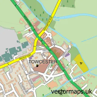
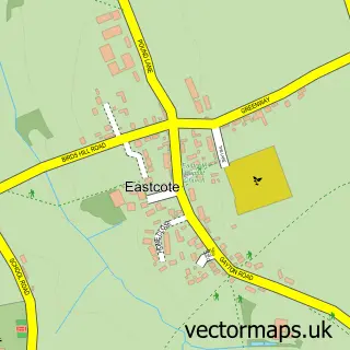
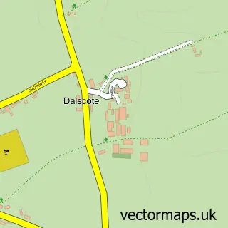
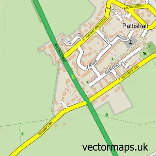
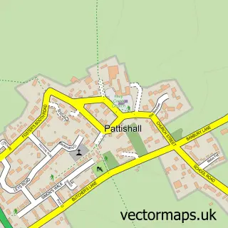
This Astcote street map is a detailed vector street map covering a 750m x 750m area. Select a larger area to create and download your own vector street map of Astcote.

Astcote is a village in Northamptonshire, in the East Midlands of England. The settlement falls within the South Northamptonshire parliamentary constituency. It is served by the NN12 postcode district, with NN12 8 as the local postcode sector.

The 750-metre map sample for Astcote covers 137 mapped buildings and approximately 9.2 km of road detail, of which 5 named roads are named. The immediate area includes 2 MOT stations within 2 miles. To create a larger or custom map of Astcote, the map builder lets you define your own coverage area and download editable SVG, PDF and PNG files.

137Buildings
9.21 kmRoads
5Named roads
1,130Residents within 2 miles
Create your own

Create a larger editable map of Astcote

Choose any area you need and generate a high-quality vector map instantly. Perfect for print, planning, design, business and personal use.

Choose any location
Editable SVG files
Any size up to A0
PDF, PNG & more
Instant download
High quality guaranteed
Create My Custom Map
Secure, private & no credit card required
Astcote Vector Street Map
750m Sample
Astcote vector street map sample showing roads, buildings and local features in a 750 metre preview area
Buy Astcote Map Print from £12.95 Buy Astcote Digital Map from £6

This Astcote street map in Northamptonshire is available as downloadable SVG, PDF and PNG map files, or as a printed map for planning, business, display, education, local information and design work. You can also create a larger custom map area using the map selector.

What this Astcote map sample shows

Astcote lies within Pattishall Cp parish, part of Blakesley And Cote ward in the West Northamptonshire local authority area. The postcode geography for this area includes the NN postcode area, the NN12 postcode district and the NN12 8 postcode sector. Residents fall under the Nhs Northamptonshire Integrated Care Board for NHS services.

Local features near Astcote

Within 2 miles

Amenities and services in and around Astcote.

2 MOT stations within 2 miles

Counts are approximate and based on publicly available data.

Administrative and postcode information for Astcote

The local authority covering Astcote is West Northamptonshire, within the county of Northamptonshire. The settlement lies within Blakesley And Cote ward and Pattishall Cp civil parish. The NN12 postcode district and NN12 8 postcode sector serve the immediate area. NHS provision in the area is delivered through Northampton General Hospital Nhs Trust.

Parish Pattishall CP
Ward Blakesley and Cote
District / local authority West Northamptonshire
County Northamptonshire
Historic county Northamptonshire
Postcode district NN12
Postcode sector NN12 8
Parliamentary constituency South Northamptonshire
Region East Midlands
Country England

Nearby street map samples around Astcote

Street map sample of Towcester, Northamptonshire Towcester Town - Northamptonshire - 2.9 miles Street map sample of Milton Keynes, Buckinghamshire Milton Keynes City - Buckinghamshire - 14.0 miles Street map sample of Eastcote, Northamptonshire Eastcote Village - Northamptonshire - 0.6 miles Street map sample of Dalscote, Northamptonshire Dalscote Village - Northamptonshire - 0.8 miles Street map sample of Fosters Booth, Northamptonshire Fosters Booth Village - Northamptonshire - 0.8 miles Street map sample of Pattishall, Northamptonshire Pattishall Village - Northamptonshire - 0.8 miles Street map sample of Cold Higham, Northamptonshire Cold Higham Village - Northamptonshire - 0.9 miles Street map sample of Grimscote, Northamptonshire Grimscote Village - Northamptonshire - 1.5 miles Street map sample of Tiffield, Northamptonshire Tiffield Village - Northamptonshire - 1.6 miles Street map sample of Gayton, Northamptonshire Gayton Village - Northamptonshire - 1.9 miles

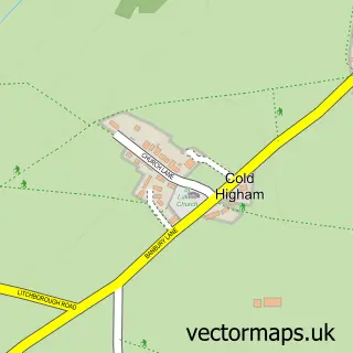
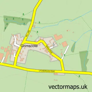
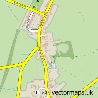
More street maps in Northamptonshire

Street map sample of Eastcote, Northamptonshire Eastcote Village - 0.6 miles Street map sample of Dalscote, Northamptonshire Dalscote Village - 0.8 miles Street map sample of Fosters Booth, Northamptonshire Fosters Booth Village - 0.8 miles Street map sample of Pattishall, Northamptonshire Pattishall Village - 0.8 miles Street map sample of Cold Higham, Northamptonshire Cold Higham Village - 0.9 miles

750 metre map area coverage

Boundary, postcode and point of interest information for the 750m x 750m rectangle centred on this sample map.

Boundaries containing map centre

Constituency: South Northamptonshire Co Const

District: West Northamptonshire

Icb: NHS Northamptonshire ICB

Parish: Pattishall CP

Police Force: northamptonshire

Postcode District: NN12

Postcode Sector: NN12 8

Ward: Towcester Ward

Nearby boundaries intersecting sample

No additional intersecting boundaries found.

Postcode coverage

NN12 NN12 8

POI category counts

Professional Services: 2

Bakery: 1

Day Care Preschool: 1

Dog Walkers: 1

Event Planning: 1

Financial Service: 1

Gardener: 1

Pet Services: 1

Travel Agents: 1

Sample points of interest

  • Angelina Cupcake Bakery
  • Cheeky Faces Childcare Day Care Preschool
  • Buddy's Pet Services Dog Walkers
  • Ducathen Event Planning
  • Adam Smith Mortgage Adviser Financial Service
  • Dale Landscapes Gardener
  • Jackador Pet Services
  • LJPhotostop Professional Services
  • Silverstone Paint Technology Professional Services
  • Personal Travel Agents At Co-op Travel Travel Agents

Create a larger editable map of Astcote

This sample shows only a 750 metre area. To create a larger map of Astcote, use our map builder to choose your own coverage area, add titles and download editable SVG, PDF and PNG files.

Create a custom map of Astcote

Phone 01751 473136 | Copyright Vectormaps.uk 2026

Samples Customizer Privacy Disclaimer
Astcote Vector Street Map
Astcote enlarged street map sample showing a 750 metre preview area