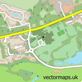
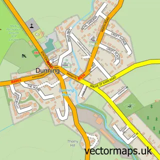
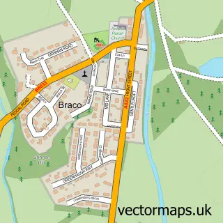
This Auchterarder street map is a detailed vector street map covering a 750m x 750m area. Select a larger area to create and download your own vector street map of Auchterarder.
The 750-metre map sample for Auchterarder covers 249 mapped buildings and approximately 16.4 km of road detail, of which 40 named roads are named. The immediate area includes 1 GP surgery within 2 miles, 1 pub and 1 MOT station, with 2 within 2 miles. The wider area around Auchterarder features 1 tourism point of interest, 8 food and drink venues and 4 hotels. To create a larger or custom map of Auchterarder, the map builder lets you define your own coverage area and download editable SVG, PDF and PNG files.
Create a larger editable map of Auchterarder
Choose any area you need and generate a high-quality vector map instantly. Perfect for print, planning, design, business and personal use.

This Auchterarder street map in Perth and Kinross is available as downloadable SVG, PDF and PNG map files, or as a printed map for planning, business, display, education, local information and design work. You can also create a larger custom map area using the map selector.
What this Auchterarder map sample shows
Auchterarder lies within Perth And Kinross parish, part of Strathallan ward in the Perth And Kinross local authority area. The postcode geography for this area includes the PH postcode area, the PH3 postcode district and the PH3 1 postcode sector. Residents fall under the Tayside for NHS services.
Local features near Auchterarder
Within 2 milesAmenities and services in and around Auchterarder.
Administrative and postcode information for Auchterarder
Auchterarder lies within Perth And Kinross parish, part of Strathallan ward in the Perth And Kinross local authority area. The postcode geography for this area includes the PH postcode area, the PH3 postcode district and the PH3 1 postcode sector. Residents fall under the Tayside for NHS services.
Nearby street map samples around Auchterarder

More street maps in Perth and Kinross
750 metre map area coverage
Boundary, postcode and point of interest information for the 750m x 750m rectangle centred on this sample map.
Boundaries containing map centre
Constituency: Stirling and Strathallan Co Const
District: Perth and Kinross
Icb: Tayside
Postcode District: PH3
Postcode Sector: PH3 1
Ward: Strathallan Ward
Nearby boundaries intersecting sample
No additional intersecting boundaries found.
Postcode coverage
POI category counts
Beauty Salon: 7
Clothing Store: 6
Hair Salon: 6
Gym: 5
Banks: 4
Cafe: 4
Hotel: 4
Bakery: 3
Barber: 3
Building Supply Store: 3
Sample points of interest
- Golf Inn
- Chest, Heart, And Stroke Scotland Boutique
- DNG Contemporary Art
- The Ruthven Gallery
- Jammy Things
- The Cooperative Food (BF) Auchterarder (ERF)
- APC Community Garden
- ACC valeting & detailing
- Auchterarder Motors Ltd
- Auto & Plant
- Marie's Little Cake Shop
- Sugar & Spice
Create a larger editable map of Auchterarder
This sample shows only a 750 metre area. To create a larger map of Auchterarder, use our map builder to choose your own coverage area, add titles and download editable SVG, PDF and PNG files.
Create a custom map of Auchterarder