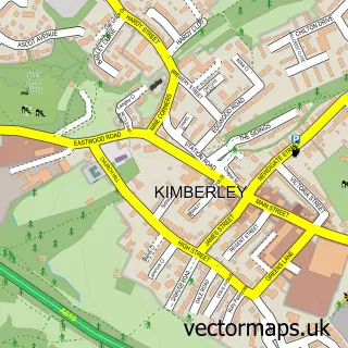
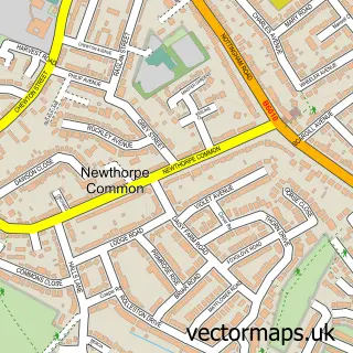
This Awsworth street map is a detailed vector street map covering a 750m x 750m area. Select a larger area to create and download your own vector street map of Awsworth.
The 750-metre map sample for Awsworth covers 500 mapped buildings and approximately 22.8 km of road detail, of which 31 named roads are named. The immediate area includes 1 school, 8 GP surgeries within 2 miles, 3 pubs and 1 MOT station, with 18 within 2 miles. The wider area around Awsworth features 3 tourism points of interest, 3 food and drink venues and 1 hotel. To create a larger or custom map of Awsworth, the map builder lets you define your own coverage area and download editable SVG, PDF and PNG files.
Create a larger editable map of Awsworth
Choose any area you need and generate a high-quality vector map instantly. Perfect for print, planning, design, business and personal use.

This Awsworth street map in Nottinghamshire is available as downloadable SVG, PDF and PNG map files, or as a printed map for planning, business, display, education, local information and design work. You can also create a larger custom map area using the map selector.
What this Awsworth map sample shows
Awsworth lies within Awsworth Cp parish, part of Awsworth, Cossall & Trowell ward in the Broxtowe District (B) local authority area. The postcode geography for this area includes the NG postcode area, the NG16 postcode district and the NG16 2 postcode sector. Residents fall under the Nhs Nottingham And Nottinghamshire Integrated Care Board for NHS services.
Local features near Awsworth
Within 2 milesAmenities and services in and around Awsworth.
Administrative and postcode information for Awsworth
The local authority covering Awsworth is Broxtowe District (B), within the county of Nottinghamshire. The settlement lies within Awsworth, Cossall & Trowell ward and Awsworth Cp civil parish. The NG16 postcode district and NG16 2 postcode sector serve the immediate area. NHS provision in the area is delivered through Nottingham University Hospitals Nhs Trust.
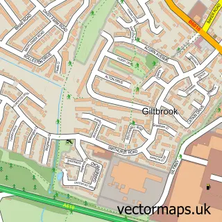
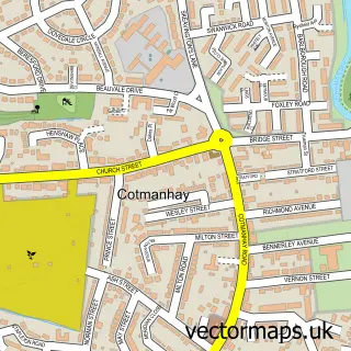
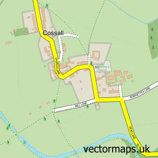
Nearby street map samples around Awsworth


More street maps in Nottinghamshire
750 metre map area coverage
Boundary, postcode and point of interest information for the 750m x 750m rectangle centred on this sample map.
Boundaries containing map centre
Constituency: Broxtowe Co Const
County: Nottinghamshire County
District: Broxtowe District (B)
Icb: NHS Nottingham and Nottinghamshire ICB
Parish: Awsworth CP
Police Force: nottinghamshire
Postcode District: NG16
Postcode Sector: NG16 2
Ward: Awsworth, Cossall & Trowell Ward
Nearby boundaries intersecting sample
Constituency: Nottingham North and Kimberley Boro Const
Parish: Cossall CP
Postcode coverage
POI category counts
Convenience Store: 3
Elementary School: 3
Professional Services: 3
Pub: 3
Building Supply Store: 2
Community Center: 2
Food Delivery Service: 2
Park: 2
Preschool: 2
Anglican Church: 1
Sample points of interest
- St Peter
- PayPoint
- Total vehicle solutions
- Hoorah's Bar
- Awsworth Barbershop
- Fliss N Glitz
- The Chocolate Chief
- 1st P L P Electrical
- Midland Gate Automation
- Eclipse Office Services
- The Awsworth School House Day Nursery
- Djsweeps Ltd
Create a larger editable map of Awsworth
This sample shows only a 750 metre area. To create a larger map of Awsworth, use our map builder to choose your own coverage area, add titles and download editable SVG, PDF and PNG files.
Create a custom map of Awsworth