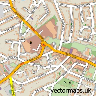
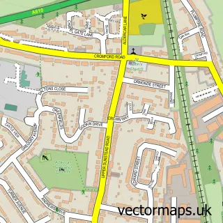
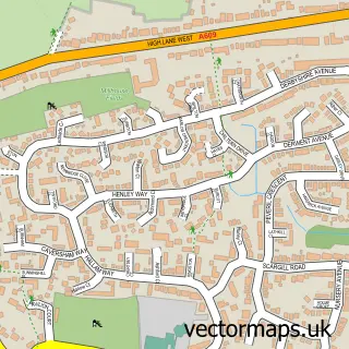
This Shipley street map is a detailed vector street map covering a 750m x 750m area. Select a larger area to create and download your own vector street map of Shipley.
The 750-metre map sample for Shipley covers 121 mapped buildings and approximately 6.8 km of road detail, of which 5 named roads are named. The immediate area includes 6 GP surgeries within 2 miles and 19 MOT stations within 2 miles. The wider area around Shipley features 1 food and drink venue. To create a larger or custom map of Shipley, the map builder lets you define your own coverage area and download editable SVG, PDF and PNG files.
Create a larger editable map of Shipley
Choose any area you need and generate a high-quality vector map instantly. Perfect for print, planning, design, business and personal use.

This Shipley street map in Derbyshire is available as downloadable SVG, PDF and PNG map files, or as a printed map for planning, business, display, education, local information and design work. You can also create a larger custom map area using the map selector.
What this Shipley map sample shows
Shipley lies within Shipley Cp parish, part of Shipley Park, Horsley And Horsley Woodhouse ward in the Amber Valley District (B) local authority area. The postcode geography for this area includes the DE postcode area, the DE75 postcode district and the DE75 7 postcode sector. Residents fall under the Nhs Derby And Derbyshire Integrated Care Board for NHS services.
Local features near Shipley
Within 2 milesAmenities and services in and around Shipley.
Administrative and postcode information for Shipley
Shipley lies within Shipley Cp parish, part of Shipley Park, Horsley And Horsley Woodhouse ward in the Amber Valley District (B) local authority area. The postcode geography for this area includes the DE postcode area, the DE75 postcode district and the DE75 7 postcode sector. Residents fall under the Nhs Derby And Derbyshire Integrated Care Board for NHS services.
Nearby street map samples around Shipley

More street maps in Derbyshire
750 metre map area coverage
Boundary, postcode and point of interest information for the 750m x 750m rectangle centred on this sample map.
Boundaries containing map centre
Constituency: Amber Valley Co Const
County: Derbyshire County
District: Amber Valley District (B)
Icb: NHS Derby and Derbyshire ICB
Parish: Shipley CP
Police Force: derbyshire
Postcode District: DE75
Postcode Sector: DE75 7
Ward: Smalley, Shipley & Horsley Woodhouse Ward
Nearby boundaries intersecting sample
No additional intersecting boundaries found.
Postcode coverage
POI category counts
Automotive: 2
Car Dealer: 2
Used Car Dealer: 2
Builders: 1
Community Services Non Profits: 1
Contractor: 1
Convenience Store: 1
Dance School: 1
Educational Services: 1
Fireplace Service: 1
Sample points of interest
- Justcomparecars.com
- Www.justcomparecars.com
- Shipley Lakeside - Avant Homes
- Capital House Marketing
- Just Compare Cars
- Shipley Parish Room
- A J Construction
- Premier Quix
- Rising Stars School of Performing Arts
- C G Drum Tuition
- Alan Doxey Fireplaces
- MW Glass & Glazing
Create a larger editable map of Shipley
This sample shows only a 750 metre area. To create a larger map of Shipley, use our map builder to choose your own coverage area, add titles and download editable SVG, PDF and PNG files.
Create a custom map of Shipley