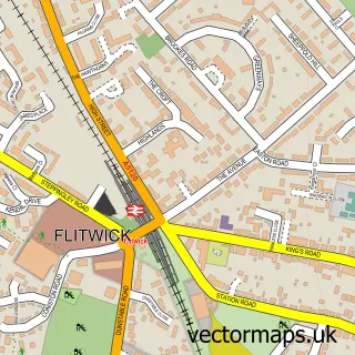
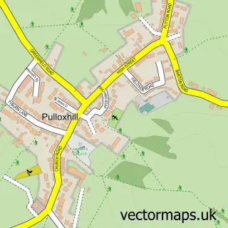
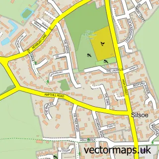
This Barton-le-Clay street map is a detailed vector street map covering a 750m x 750m area. Select a larger area to create and download your own vector street map of Barton-le-Clay.
The 750-metre map sample for Barton-le-Clay covers 566 mapped buildings and approximately 19.1 km of road detail, of which 43 named roads are named. The immediate area includes 1 GP surgery and 4 pubs. The wider area around Barton-le-Clay features 7 food and drink venues. To create a larger or custom map of Barton-le-Clay, the map builder lets you define your own coverage area and download editable SVG, PDF and PNG files.
Create a larger editable map of Barton-le-Clay
Choose any area you need and generate a high-quality vector map instantly. Perfect for print, planning, design, business and personal use.

This Barton-le-Clay street map in Bedfordshire is available as downloadable SVG, PDF and PNG map files, or as a printed map for planning, business, display, education, local information and design work. You can also create a larger custom map area using the map selector.
What this Barton-le-Clay map sample shows
Barton-le-Clay lies within Barton-Le-Clay Cp parish, part of Barton-Le-Clay ward in the Central Bedfordshire local authority area. The postcode geography for this area includes the MK postcode area, the MK45 postcode district and the MK45 4 postcode sector. Residents fall under the Nhs Bedfordshire, Luton And Milton Keynes Integrated Care Board for NHS services.
Local features near Barton-le-Clay
Within 2 milesAmenities and services in and around Barton-le-Clay.
Administrative and postcode information for Barton-le-Clay
Barton-le-Clay lies within Barton-Le-Clay Cp parish, part of Barton-Le-Clay ward in the Central Bedfordshire local authority area. The postcode geography for this area includes the MK postcode area, the MK45 postcode district and the MK45 4 postcode sector. Residents fall under the Nhs Bedfordshire, Luton And Milton Keynes Integrated Care Board for NHS services.
Nearby street map samples around Barton-le-Clay

More street maps in Bedfordshire
750 metre map area coverage
Boundary, postcode and point of interest information for the 750m x 750m rectangle centred on this sample map.
Boundaries containing map centre
Constituency: Mid Bedfordshire Co Const
District: Central Bedfordshire
Icb: NHS Central East ICB
Parish: Barton-le-Clay CP
Police Force: bedfordshire
Postcode District: MK45
Postcode Sector: MK45 4
Ward: Barton-le-Clay & Silsoe Ward
Nearby boundaries intersecting sample
No additional intersecting boundaries found.
Postcode coverage
POI category counts
Beauty Salon: 6
Doctor: 4
Pub: 4
Bakery: 3
Beauty And Spa: 3
Shipping Center: 3
Banks: 2
Barber: 2
Burger Restaurant: 2
Carpenter: 2
Sample points of interest
- Colwell Design
- Barton Watermill Restaurant
- Redwood House
- The Cooperative Food Barton le Clay, Barton le Clay
- Cleo's Creative Cakes
- Pieces Bakery
- Piper's Cakes
- Lloyds Bank
- TSB Bank
- Phill's barber studio
- The Barbers
- AmyB - Lashes, Brows & PMU
Create a larger editable map of Barton-le-Clay
This sample shows only a 750 metre area. To create a larger map of Barton-le-Clay, use our map builder to choose your own coverage area, add titles and download editable SVG, PDF and PNG files.
Create a custom map of Barton-le-Clay