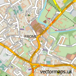
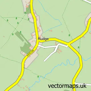
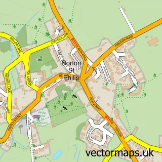
This Beckington street map is a detailed vector street map covering a 750m x 750m area. Select a larger area to create and download your own vector street map of Beckington.
The 750-metre map sample for Beckington covers 311 mapped buildings and approximately 12.9 km of road detail, of which 24 named roads are named. The immediate area includes 2 schools, 1 GP surgery, 1 pub and 1 MOT station, with 4 within 2 miles. The wider area around Beckington features 1 tourism point of interest, 3 food and drink venues and 3 hotels. To create a larger or custom map of Beckington, the map builder lets you define your own coverage area and download editable SVG, PDF and PNG files.
Create a larger editable map of Beckington
Choose any area you need and generate a high-quality vector map instantly. Perfect for print, planning, design, business and personal use.

This Beckington street map in Somerset is available as downloadable SVG, PDF and PNG map files, or as a printed map for planning, business, display, education, local information and design work. You can also create a larger custom map area using the map selector.
What this Beckington map sample shows
Beckington lies within Beckington Cp parish, part of Beckington And Selwood ward in the Somerset local authority area. The postcode geography for this area includes the BA postcode area, the BA11 postcode district and the BA11 6 postcode sector. Residents fall under the Nhs Somerset Integrated Care Board for NHS services.
Local features near Beckington
Within 2 milesAmenities and services in and around Beckington.
Administrative and postcode information for Beckington
Beckington lies within Beckington Cp parish, part of Beckington And Selwood ward in the Somerset local authority area. The postcode geography for this area includes the BA postcode area, the BA11 postcode district and the BA11 6 postcode sector. Residents fall under the Nhs Somerset Integrated Care Board for NHS services.
Nearby street map samples around Beckington

More street maps in Somerset
750 metre map area coverage
Boundary, postcode and point of interest information for the 750m x 750m rectangle centred on this sample map.
Boundaries containing map centre
Constituency: Frome and East Somerset Co Const
District: Somerset
Icb: NHS Somerset ICB
Parish: Beckington CP
Police Force: avon and somerset
Postcode District: BA11
Postcode Sector: BA11 6
Nearby boundaries intersecting sample
No additional intersecting boundaries found.
Postcode coverage
POI category counts
Hotel: 3
Bed And Breakfast: 2
Amusement Park: 1
Anglican Church: 1
Automotive Repair: 1
Bar: 1
Building Supply Store: 1
Cafe: 1
Caterer: 1
Church Cathedral: 1
Sample points of interest
- Ellie Clarke Equestrian
- St George's, Beckington
- Beckington Motors | Frome
- Foresters Arms
- Old Parsonage House
- The Foresters
- Frome Scaffolding
- Mes Amis
- Glenard
- Church of St George
- St. Lukes Surgery
- Somerset County Council
Create a larger editable map of Beckington
This sample shows only a 750 metre area. To create a larger map of Beckington, use our map builder to choose your own coverage area, add titles and download editable SVG, PDF and PNG files.
Create a custom map of Beckington