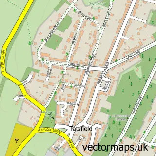
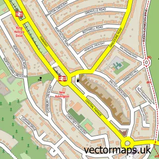
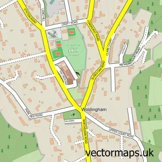
This Biggin Hill street map is a detailed vector street map covering a 750m x 750m area. Select a larger area to create and download your own vector street map of Biggin Hill.
The 750-metre map sample for Biggin Hill covers 378 mapped buildings and approximately 15.1 km of road detail, of which 29 named roads are named. The immediate area includes 2 GP surgeries within 2 miles, 2 pubs and 2 MOT stations, with 5 within 2 miles. The wider area around Biggin Hill features 1 tourism point of interest and 3 food and drink venues. To create a larger or custom map of Biggin Hill, the map builder lets you define your own coverage area and download editable SVG, PDF and PNG files.
Create a larger editable map of Biggin Hill
Choose any area you need and generate a high-quality vector map instantly. Perfect for print, planning, design, business and personal use.

This Biggin Hill street map in Greater London is available as downloadable SVG, PDF and PNG map files, or as a printed map for planning, business, display, education, local information and design work. You can also create a larger custom map area using the map selector.
What this Biggin Hill map sample shows
Biggin Hill lies within Greater London Authority parish, part of Biggin Hill ward in the Bromley London Boro local authority area. The postcode geography for this area includes the TN postcode area, the TN16 postcode district and the TN16 3 postcode sector. Residents fall under the Nhs South East London Integrated Care Board for NHS services.
Local features near Biggin Hill
Within 2 milesAmenities and services in and around Biggin Hill.
Administrative and postcode information for Biggin Hill
Biggin Hill lies within Greater London Authority parish, part of Biggin Hill ward in the Bromley London Boro local authority area. The postcode geography for this area includes the TN postcode area, the TN16 postcode district and the TN16 3 postcode sector. Residents fall under the Nhs South East London Integrated Care Board for NHS services.
Nearby street map samples around Biggin Hill

More street maps in Greater London
750 metre map area coverage
Boundary, postcode and point of interest information for the 750m x 750m rectangle centred on this sample map.
Boundaries containing map centre
Constituency: Bromley and Biggin Hill Boro Const
County: Greater London Authority
District: Bromley London Boro
Icb: NHS South East London ICB
Police Force: metropolitan
Postcode District: TN16
Postcode Sector: TN16 3
Ward: Biggin Hill Ward
Nearby boundaries intersecting sample
No additional intersecting boundaries found.
Postcode coverage
POI category counts
Building Supply Store: 6
Automotive Repair: 3
Beauty Salon: 3
Business Management Services: 3
Post Office: 3
Arts And Crafts: 2
Atms: 2
Auto Electrical Repair: 2
Contractor: 2
Convenience Store: 2
Sample points of interest
- Jet Aviation
- Glitter Box
- Glitterbox Art and Craft
- Asda (C) Biggin Hill - Main Road PFS, Biggin Hill
- Morrisons Daily - Biggin Hill Roundway, Biggin Hill
- Fix Auto Biggin Hill
- Bromley Security Systems
- Cloud Electrical Ltd.
- Supercar Italia Limited
- Motorist Centre
- Motorwerx
- The Motorist Centre
Create a larger editable map of Biggin Hill
This sample shows only a 750 metre area. To create a larger map of Biggin Hill, use our map builder to choose your own coverage area, add titles and download editable SVG, PDF and PNG files.
Create a custom map of Biggin Hill