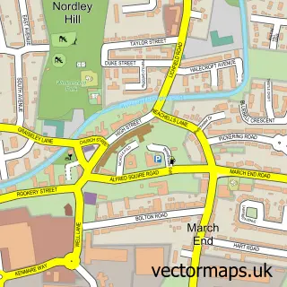
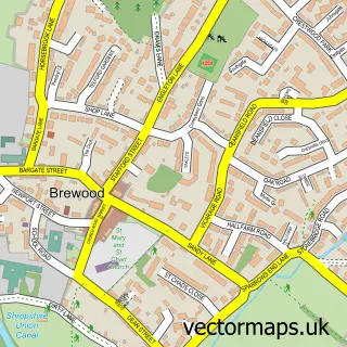
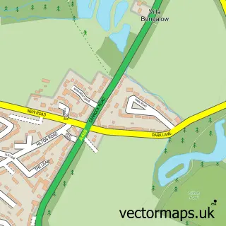
This Bilbrook street map is a detailed vector street map covering a 750m x 750m area. Select a larger area to create and download your own vector street map of Bilbrook.
The 750-metre map sample for Bilbrook covers 387 mapped buildings and approximately 16.0 km of road detail, of which 40 named roads are named. The immediate area includes 1 primary school and 1 secondary school, 1 GP surgery, with 2 within 2 miles, 3 pubs and 1 MOT station within 2 miles. The wider area around Bilbrook features 1 tourism point of interest and 6 food and drink venues. To create a larger or custom map of Bilbrook, the map builder lets you define your own coverage area and download editable SVG, PDF and PNG files.
Create a larger editable map of Bilbrook
Choose any area you need and generate a high-quality vector map instantly. Perfect for print, planning, design, business and personal use.

This Bilbrook street map in Staffordshire is available as downloadable SVG, PDF and PNG map files, or as a printed map for planning, business, display, education, local information and design work. You can also create a larger custom map area using the map selector.
What this Bilbrook map sample shows
Bilbrook lies within Bilbrook Cp parish, part of Bilbrook ward in the South Staffordshire District local authority area. The postcode geography for this area includes the WV postcode area, the WV8 postcode district and the WV8 1 postcode sector. Residents fall under the Nhs Staffordshire And Stoke-On-Trent Integrated Care Board for NHS services.
Local features near Bilbrook
Within 2 milesAmenities and services in and around Bilbrook.
Administrative and postcode information for Bilbrook
Bilbrook lies within Bilbrook Cp parish, part of Bilbrook ward in the South Staffordshire District local authority area. The postcode geography for this area includes the WV postcode area, the WV8 postcode district and the WV8 1 postcode sector. Residents fall under the Nhs Staffordshire And Stoke-On-Trent Integrated Care Board for NHS services.
Nearby street map samples around Bilbrook

More street maps in Staffordshire
750 metre map area coverage
Boundary, postcode and point of interest information for the 750m x 750m rectangle centred on this sample map.
Boundaries containing map centre
Constituency: Kingswinford and South Staffordshire Co Const
County: Staffordshire County
District: South Staffordshire District
Icb: NHS Black Country ICB
Parish: Bilbrook CP
Police Force: staffordshire
Postcode District: WV8
Postcode Sector: WV8 1
Ward: Bilbrook Ward
Nearby boundaries intersecting sample
Constituency: Stone, Great Wyrley and Penkridge Co Const
Parish: Codsall CP
Ward: Brewood, Coven & Blymhill Ward, Codsall Ward
Postcode coverage
POI category counts
Beauty Salon: 4
Convenience Store: 4
Professional Services: 4
Barber: 3
Pub: 3
Advertising Agency: 2
Building Supply Store: 2
Business Management Services: 2
Cafe: 2
Community Services Non Profits: 2
Sample points of interest
- Bilbrook Shropshire Union Canal
- Bespoke Wedding Consultants
- Bespoke Wedding Consultants
- Church of the Holy Cross, Bilbrook
- Swift Appliance Repair
- Midland Heart
- Select Car Leasing
- M&D Bodyshop and Parts LTD
- Motor World Codsall
- Barclays Bank - Bilbrook
- TRiM Barbershops
- Trim Barbers Shop
Create a larger editable map of Bilbrook
This sample shows only a 750 metre area. To create a larger map of Bilbrook, use our map builder to choose your own coverage area, add titles and download editable SVG, PDF and PNG files.
Create a custom map of Bilbrook