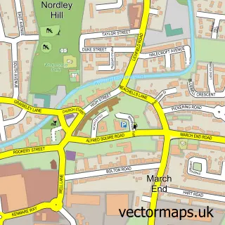
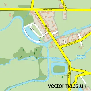
This Hilton street map is a detailed vector street map covering a 750m x 750m area. Select a larger area to create and download your own vector street map of Hilton.
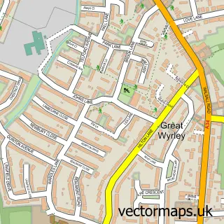
The 750-metre map sample for Hilton covers 156 mapped buildings and approximately 9.4 km of road detail, of which 14 named roads are named. The immediate area includes 2 GP surgeries within 2 miles, 1 pub and 1 MOT station, with 6 within 2 miles. The wider area around Hilton features 1 tourism point of interest and 3 food and drink venues. To create a larger or custom map of Hilton, the map builder lets you define your own coverage area and download editable SVG, PDF and PNG files.
Create a larger editable map of Hilton
Choose any area you need and generate a high-quality vector map instantly. Perfect for print, planning, design, business and personal use.

This Hilton street map in Staffordshire is available as downloadable SVG, PDF and PNG map files, or as a printed map for planning, business, display, education, local information and design work. You can also create a larger custom map area using the map selector.
What this Hilton map sample shows
Hilton lies within Hilton Cp parish, part of Featherstone And Shareshill ward in the South Staffordshire District local authority area. The postcode geography for this area includes the WV postcode area, the WV10 postcode district and the WV10 7 postcode sector. Residents fall under the Nhs Staffordshire And Stoke-On-Trent Integrated Care Board for NHS services.
Local features near Hilton
Within 2 milesAmenities and services in and around Hilton.
Administrative and postcode information for Hilton
The local authority covering Hilton is South Staffordshire District, within the county of Staffordshire. The settlement lies within Featherstone And Shareshill ward and Hilton Cp civil parish. The WV10 postcode district and WV10 7 postcode sector serve the immediate area. NHS provision in the area is delivered through The Royal Wolverhampton Nhs Trust.
Nearby street map samples around Hilton

More street maps in Staffordshire
750 metre map area coverage
Boundary, postcode and point of interest information for the 750m x 750m rectangle centred on this sample map.
Boundaries containing map centre
Constituency: Stone, Great Wyrley and Penkridge Co Const
County: Staffordshire County
District: South Staffordshire District
Icb: NHS Black Country ICB
Parish: Hilton CP
Police Force: staffordshire
Postcode District: WV10
Postcode Sector: WV10 7
Ward: Featherstone, Sharehill & Saredon Ward
Nearby boundaries intersecting sample
Parish: Featherstone CP, Shareshill CP
Postcode District: WV11
Postcode Sector: WV11 2
Postcode coverage
POI category counts
Gas Station: 4
Building Supply Store: 2
Coffee Shop: 2
Construction Services: 2
Indian Restaurant: 2
Paintball: 2
Automotive Repair: 1
Beer Bar: 1
Contractor: 1
Convenience Store: 1
Sample points of interest
- Hilton Autogas Centre
- Woodys Bar
- Highway Safety Supplies
- South West Works
- Costa Coffee
- Costa Express
- Hadley Bowen Equestrian Structures
- Highway Safety Supplies
- Street Work Services
- Premier
- Future Bound School of Motoring
- Bedlam Paintball Wolverhampton
Create a larger editable map of Hilton
This sample shows only a 750 metre area. To create a larger map of Hilton, use our map builder to choose your own coverage area, add titles and download editable SVG, PDF and PNG files.
Create a custom map of Hilton