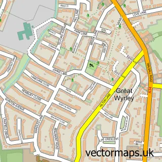
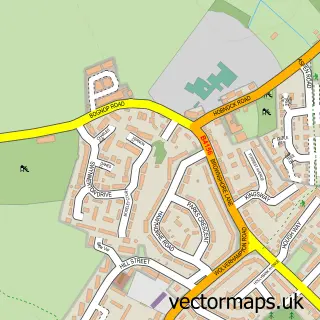
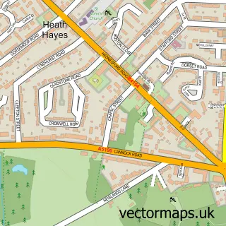
This Landywood street map is a detailed vector street map covering a 750m x 750m area. Select a larger area to create and download your own vector street map of Landywood.
The 750-metre map sample for Landywood covers 431 mapped buildings and approximately 17.8 km of road detail, of which 46 named roads are named. The immediate area includes 1 railway station, 1 GP surgery, with 5 within 2 miles and 14 MOT stations within 2 miles. To create a larger or custom map of Landywood, the map builder lets you define your own coverage area and download editable SVG, PDF and PNG files.
Create a larger editable map of Landywood
Choose any area you need and generate a high-quality vector map instantly. Perfect for print, planning, design, business and personal use.

This Landywood street map in Staffordshire is available as downloadable SVG, PDF and PNG map files, or as a printed map for planning, business, display, education, local information and design work. You can also create a larger custom map area using the map selector.
What this Landywood map sample shows
Landywood lies within Great Wyrley Cp parish, part of Great Wyrley Landywood ward in the South Staffordshire District local authority area. The postcode geography for this area includes the WS postcode area, the WS6 postcode district and the WS6 6 postcode sector. Residents fall under the Nhs Staffordshire And Stoke-On-Trent Integrated Care Board for NHS services.
Local features near Landywood
Within 2 milesAmenities and services in and around Landywood.
Administrative and postcode information for Landywood
The local authority covering Landywood is South Staffordshire District, within the county of Staffordshire. The settlement lies within Great Wyrley Landywood ward and Great Wyrley Cp civil parish. The WS6 postcode district and WS6 6 postcode sector serve the immediate area. NHS provision in the area is delivered through The Royal Wolverhampton Nhs Trust.
Nearby street map samples around Landywood
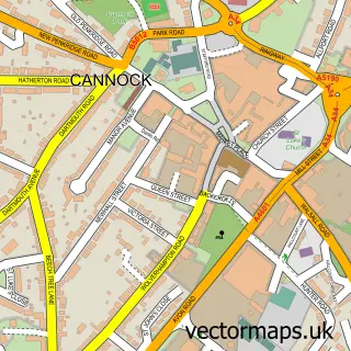

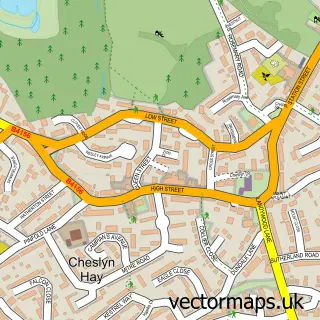
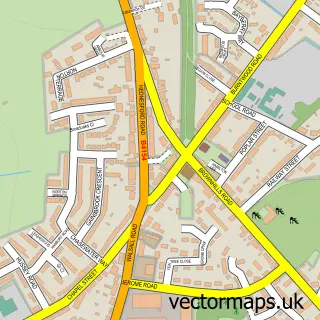
More street maps in Staffordshire
750 metre map area coverage
Boundary, postcode and point of interest information for the 750m x 750m rectangle centred on this sample map.
Boundaries containing map centre
Constituency: Stone, Great Wyrley and Penkridge Co Const
County: Staffordshire County
District: South Staffordshire District
Icb: NHS Staffordshire and Stoke-on-Trent ICB
Parish: Great Wyrley CP
Police Force: staffordshire
Postcode District: WS6
Postcode Sector: WS6 6
Ward: Great Wyrley Landywood Ward
Nearby boundaries intersecting sample
Parish: Cheslyn Hay CP
Postcode Sector: WS6 7
Ward: Cheslyn Hay Village Ward, Great Wyrley Town Ward
Postcode coverage
POI category counts
Professional Services: 3
Train Station: 3
Assisted Living Facility: 2
Beauty Salon: 2
Contractor: 2
Convenience Store: 2
Dog Walkers: 2
Family Practice: 2
Landscaping: 2
Limo Services: 2
Sample points of interest
- Great Wyrley S.Andrew, Landywood
- Bombai kitchen
- Wok and Bao
- Bentons Lane
- Oak House
- MD Installations (West Midlands) Ltd.
- Ram Express Hydraulics and Engineering
- Aisha's Kitchen
- S Reeves
- CM Aesthetics
- EDITD
- Clarky’s Bar
Create a larger editable map of Landywood
This sample shows only a 750 metre area. To create a larger map of Landywood, use our map builder to choose your own coverage area, add titles and download editable SVG, PDF and PNG files.
Create a custom map of Landywood