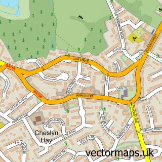
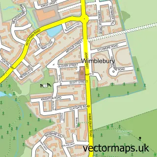
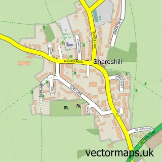
This Cannock street map is a detailed vector street map covering a 750m x 750m area. Select a larger area to create and download your own vector street map of Cannock.
The 750-metre map sample for Cannock covers 406 mapped buildings and approximately 22.5 km of road detail, of which 36 named roads are named. The immediate area includes 9 GP surgeries within 2 miles, 15 pubs and 2 MOT stations, with 32 within 2 miles. The wider area around Cannock features 2 tourism points of interest, 38 food and drink venues and 1 hotel. To create a larger or custom map of Cannock, the map builder lets you define your own coverage area and download editable SVG, PDF and PNG files.
Create a larger editable map of Cannock
Choose any area you need and generate a high-quality vector map instantly. Perfect for print, planning, design, business and personal use.

This Cannock street map in Staffordshire is available as downloadable SVG, PDF and PNG map files, or as a printed map for planning, business, display, education, local information and design work. You can also create a larger custom map area using the map selector.
What this Cannock map sample shows
Cannock lies within Staffordshire County parish, part of Cannock West ward in the Cannock Chase District local authority area. The postcode geography for this area includes the WS postcode area, the WS11 postcode district and the WS11 1 postcode sector. Residents fall under the Nhs Staffordshire And Stoke-On-Trent Integrated Care Board for NHS services.
Local features near Cannock
Within 2 milesAmenities and services in and around Cannock.
Administrative and postcode information for Cannock
The local authority covering Cannock is Cannock Chase District, within the county of Staffordshire. The settlement lies within Cannock West ward and Staffordshire County civil parish. The WS11 postcode district and WS11 1 postcode sector serve the immediate area. NHS provision in the area is delivered through The Royal Wolverhampton Nhs Trust.
Nearby street map samples around Cannock

More street maps in Staffordshire
750 metre map area coverage
Boundary, postcode and point of interest information for the 750m x 750m rectangle centred on this sample map.
Boundaries containing map centre
Constituency: Cannock Chase Co Const
County: Staffordshire County
District: Cannock Chase District
Icb: NHS Staffordshire and Stoke-on-Trent ICB
Police Force: staffordshire
Postcode District: WS11
Postcode Sector: WS11 1
Ward: Cannock Longford & Bridgtown Ward
Nearby boundaries intersecting sample
Postcode Sector: WS11 0, WS11 4
Ward: Cannock Park & Old Fallow Ward
Postcode coverage
POI category counts
Beauty Salon: 24
Beauty And Spa: 17
Hair Salon: 17
Pub: 15
Professional Services: 13
Clothing Store: 12
Mobile Phone Store: 11
Coffee Shop: 10
Restaurant: 8
Bank Credit Union: 7
Sample points of interest
- Exactax Ltd.
- Shelvoke Pickering Janney
- Silver & Co. Accountants
- Silver Company Chartered Accountants
- Cannock Clinical Acupuncture and Bio Resonance
- Gaynor Grozier Acupuncture
- Connexions
- iNET VENTURES
- Cannock United Football Club
- Shipley's Gaming
- Stakapal
- The Deal Machine
Create a larger editable map of Cannock
This sample shows only a 750 metre area. To create a larger map of Cannock, use our map builder to choose your own coverage area, add titles and download editable SVG, PDF and PNG files.
Create a custom map of Cannock