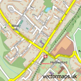
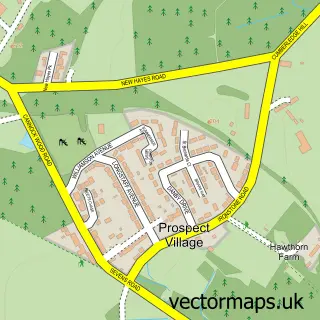
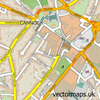
This Huntington street map is a detailed vector street map covering a 750m x 750m area. Select a larger area to create and download your own vector street map of Huntington.
The 750-metre map sample for Huntington covers 246 mapped buildings and approximately 10.9 km of road detail, of which 24 named roads are named. The immediate area includes 1 school, 7 GP surgeries within 2 miles, 3 pubs and 1 MOT station, with 18 within 2 miles. The wider area around Huntington features 1 tourism point of interest, 4 food and drink venues and 1 hotel. To create a larger or custom map of Huntington, the map builder lets you define your own coverage area and download editable SVG, PDF and PNG files.
Create a larger editable map of Huntington
Choose any area you need and generate a high-quality vector map instantly. Perfect for print, planning, design, business and personal use.

This Huntington street map in Staffordshire is available as downloadable SVG, PDF and PNG map files, or as a printed map for planning, business, display, education, local information and design work. You can also create a larger custom map area using the map selector.
What this Huntington map sample shows
Huntington lies within Huntington Cp parish, part of Huntington And Hatherton ward in the South Staffordshire District local authority area. The postcode geography for this area includes the WS postcode area, the WS12 postcode district and the WS12 4 postcode sector. Residents fall under the Nhs Staffordshire And Stoke-On-Trent Integrated Care Board for NHS services.
Local features near Huntington
Within 2 milesAmenities and services in and around Huntington.
Administrative and postcode information for Huntington
The local authority covering Huntington is South Staffordshire District, within the county of Staffordshire. The settlement lies within Huntington And Hatherton ward and Huntington Cp civil parish. The WS12 postcode district and WS12 4 postcode sector serve the immediate area. NHS provision in the area is delivered through The Royal Wolverhampton Nhs Trust.
Nearby street map samples around Huntington


More street maps in Staffordshire
750 metre map area coverage
Boundary, postcode and point of interest information for the 750m x 750m rectangle centred on this sample map.
Boundaries containing map centre
Constituency: Stone, Great Wyrley and Penkridge Co Const
County: Staffordshire County
District: South Staffordshire District
Icb: NHS Staffordshire and Stoke-on-Trent ICB
Parish: Huntington CP
Police Force: staffordshire
Postcode District: WS12
Postcode Sector: WS12 4
Ward: Huntington & Hatherton Ward
Nearby boundaries intersecting sample
No additional intersecting boundaries found.
Postcode coverage
POI category counts
Business Management Services: 3
Professional Services: 3
Pub: 3
Bed And Breakfast: 2
Church Cathedral: 2
Contractor: 2
Elementary School: 2
Auto Loan Provider: 1
Automobile Leasing: 1
Beauty Salon: 1
Sample points of interest
- Armchair Mortgages
- Total Fleet Services
- The i Brow Clinic
- Cottage Guest House
- The Cottage
- Littleton Fryer
- Chase Garage Doors Ltd.
- Chase Garage Doors Ltd.
- S2 Fire Solutions
- Jethros Marinades and Sauces
- Create Church
- Hope Baptist Church
Create a larger editable map of Huntington
This sample shows only a 750 metre area. To create a larger map of Huntington, use our map builder to choose your own coverage area, add titles and download editable SVG, PDF and PNG files.
Create a custom map of Huntington