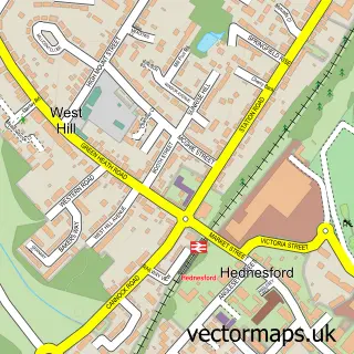
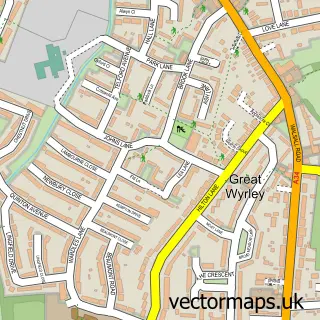
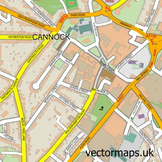
This Heath Hayes street map is a detailed vector street map covering a 750m x 750m area. Select a larger area to create and download your own vector street map of Heath Hayes.
The 750-metre map sample for Heath Hayes covers 527 mapped buildings and approximately 28.1 km of road detail, of which 30 named roads are named. The immediate area includes 1 GP surgery, with 9 within 2 miles, 5 pubs and 3 MOT stations, with 28 within 2 miles. The wider area around Heath Hayes features 8 food and drink venues and 1 hotel. To create a larger or custom map of Heath Hayes, the map builder lets you define your own coverage area and download editable SVG, PDF and PNG files.
Create a larger editable map of Heath Hayes
Choose any area you need and generate a high-quality vector map instantly. Perfect for print, planning, design, business and personal use.

This Heath Hayes street map in Staffordshire is available as downloadable SVG, PDF and PNG map files, or as a printed map for planning, business, display, education, local information and design work. You can also create a larger custom map area using the map selector.
What this Heath Hayes map sample shows
Heath Hayes lies within Heath Hayes And Wimblebury Cp parish, part of Heath Hayes East And Wimblebury ward in the Cannock Chase District local authority area. The postcode geography for this area includes the WS postcode area, the WS12 postcode district and the WS12 3 postcode sector. Residents fall under the Nhs Staffordshire And Stoke-On-Trent Integrated Care Board for NHS services.
Local features near Heath Hayes
Within 2 milesAmenities and services in and around Heath Hayes.
Administrative and postcode information for Heath Hayes
The local authority covering Heath Hayes is Cannock Chase District, within the county of Staffordshire. The settlement lies within Heath Hayes East And Wimblebury ward and Heath Hayes And Wimblebury Cp civil parish. The WS12 postcode district and WS12 3 postcode sector serve the immediate area. NHS provision in the area is delivered through The Royal Wolverhampton Nhs Trust.
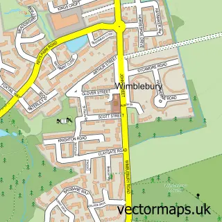
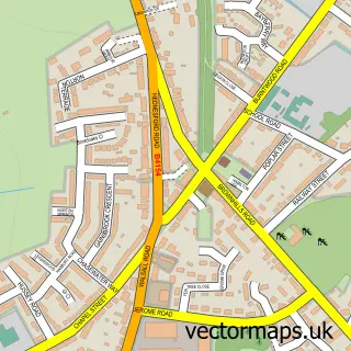
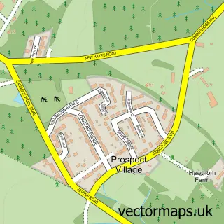
Nearby street map samples around Heath Hayes


More street maps in Staffordshire
750 metre map area coverage
Boundary, postcode and point of interest information for the 750m x 750m rectangle centred on this sample map.
Boundaries containing map centre
Constituency: Cannock Chase Co Const
County: Staffordshire County
District: Cannock Chase District
Icb: NHS Staffordshire and Stoke-on-Trent ICB
Parish: Heath Hayes and Wimblebury CP
Police Force: staffordshire
Postcode District: WS12
Postcode Sector: WS12 3
Ward: Heath Hayes & Wimblebury Ward
Nearby boundaries intersecting sample
Parish: Norton Canes CP
Postcode District: WS11
Postcode Sector: WS11 9, WS12 2
Ward: Norton Canes Ward
Postcode coverage
POI category counts
Beauty Salon: 9
Convenience Store: 6
Building Supply Store: 5
Pub: 5
Automotive Repair: 4
Funeral Services And Cemeteries: 4
Bakery: 3
Beauty And Spa: 3
Church Cathedral: 3
Contractor: 3
Sample points of interest
- Connect Business Systems
- St. John's Heath Hayes
- HHM Power Tool Service Centre
- ATM (Post Office)
- Solar Screens (Midlands) Ltd.
- J B Moto
- Paint Saint
- Perkins Bros
- Perkins Bros Garage
- BakeAway Heath Hayes
- Cakes for Occasions
- Cakes for Occasions & Sugarcraft Centre
Create a larger editable map of Heath Hayes
This sample shows only a 750 metre area. To create a larger map of Heath Hayes, use our map builder to choose your own coverage area, add titles and download editable SVG, PDF and PNG files.
Create a custom map of Heath Hayes