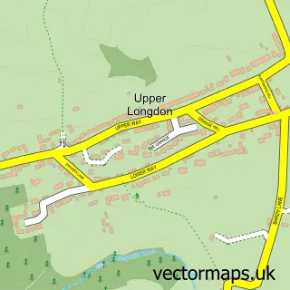
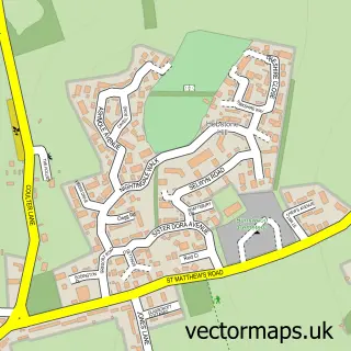
This Cannock Wood street map is a detailed vector street map covering a 750m x 750m area. Select a larger area to create and download your own vector street map of Cannock Wood.
The 750-metre map sample for Cannock Wood covers 242 mapped buildings and approximately 22.3 km of road detail, of which 20 named roads are named. The immediate area includes 1 school, 2 GP surgeries within 2 miles, 3 pubs and 4 MOT stations within 2 miles. The wider area around Cannock Wood features 3 food and drink venues and 1 campsite within 2 miles. To create a larger or custom map of Cannock Wood, the map builder lets you define your own coverage area and download editable SVG, PDF and PNG files.
Create a larger editable map of Cannock Wood
Choose any area you need and generate a high-quality vector map instantly. Perfect for print, planning, design, business and personal use.

This Cannock Wood street map in Staffordshire is available as downloadable SVG, PDF and PNG map files, or as a printed map for planning, business, display, education, local information and design work. You can also create a larger custom map area using the map selector.
What this Cannock Wood map sample shows
Cannock Wood lies within Cannock Wood Cp parish, part of Rawnsley ward in the Cannock Chase District local authority area. The postcode geography for this area includes the WS postcode area, the WS15 postcode district and the WS15 4 postcode sector. Residents fall under the Nhs Staffordshire And Stoke-On-Trent Integrated Care Board for NHS services.
Local features near Cannock Wood
Within 2 milesAmenities and services in and around Cannock Wood.
Administrative and postcode information for Cannock Wood
The local authority covering Cannock Wood is Cannock Chase District, within the county of Staffordshire. The settlement lies within Rawnsley ward and Cannock Wood Cp civil parish. The WS15 postcode district and WS15 4 postcode sector serve the immediate area. NHS provision in the area is delivered through The Royal Wolverhampton Nhs Trust.
Nearby street map samples around Cannock Wood


More street maps in Staffordshire
750 metre map area coverage
Boundary, postcode and point of interest information for the 750m x 750m rectangle centred on this sample map.
Boundaries containing map centre
Constituency: Cannock Chase Co Const
County: Staffordshire County
District: Cannock Chase District
Icb: NHS Staffordshire and Stoke-on-Trent ICB
Parish: Cannock Wood CP
Police Force: staffordshire
Postcode District: WS15
Postcode Sector: WS15 4
Ward: Hednesford Hills & Rawnsley Ward
Nearby boundaries intersecting sample
Constituency: Lichfield Co Const
District: Lichfield District
Icb: NHS Black Country ICB
Parish: Longdon CP
Ward: Longdon Ward
Postcode coverage
POI category counts
Driving School: 4
Pet Boarding: 4
Pub: 3
Community Center: 2
Anglican Church: 1
Beauty Salon: 1
Business Office Supplies And Stationery: 1
Church Cathedral: 1
Contractor: 1
Elementary School: 1
Sample points of interest
- Christ Church
- Renting a Chair at Jacques Salon
- Science Supplies
- Gentleshaw Church
- Cannock Wood and Gentleshaw Village Hall
- Gentleshaw Village Hall
- A & B Screeding
- Accelerate Driving School
- Accelerate School Motoring
- Harry Johnson Driving School
- PARKERS Driver Training
- Gentleshaw Primary School
Create a larger editable map of Cannock Wood
This sample shows only a 750 metre area. To create a larger map of Cannock Wood, use our map builder to choose your own coverage area, add titles and download editable SVG, PDF and PNG files.
Create a custom map of Cannock Wood