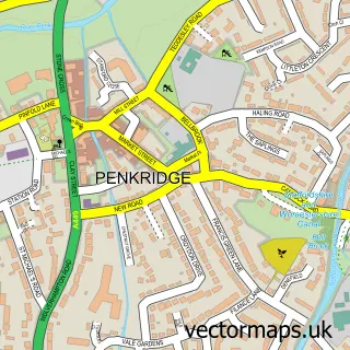
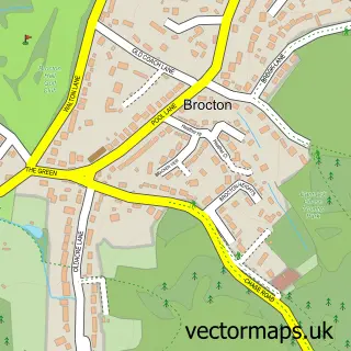
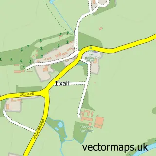
This Acton Trussell street map is a detailed vector street map covering a 750m x 750m area. Select a larger area to create and download your own vector street map of Acton Trussell.
The 750-metre map sample for Acton Trussell covers 259 mapped buildings and approximately 14.5 km of road detail, of which 21 named roads are named. The immediate area includes 3 MOT stations within 2 miles. The wider area around Acton Trussell features 1 hotel. To create a larger or custom map of Acton Trussell, the map builder lets you define your own coverage area and download editable SVG, PDF and PNG files.
Create a larger editable map of Acton Trussell
Choose any area you need and generate a high-quality vector map instantly. Perfect for print, planning, design, business and personal use.

This Acton Trussell street map in Staffordshire is available as downloadable SVG, PDF and PNG map files, or as a printed map for planning, business, display, education, local information and design work. You can also create a larger custom map area using the map selector.
What this Acton Trussell map sample shows
Acton Trussell lies within Acton Trussell And Bednall Cp parish, part of Penkridge North East And Acton Trussell ward in the South Staffordshire District local authority area. The postcode geography for this area includes the ST postcode area, the ST17 postcode district and the ST17 0 postcode sector. Residents fall under the Nhs Staffordshire And Stoke-On-Trent Integrated Care Board for NHS services.
Local features near Acton Trussell
Within 2 milesAmenities and services in and around Acton Trussell.
Administrative and postcode information for Acton Trussell
Acton Trussell lies within Acton Trussell And Bednall Cp parish, part of Penkridge North East And Acton Trussell ward in the South Staffordshire District local authority area. The postcode geography for this area includes the ST postcode area, the ST17 postcode district and the ST17 0 postcode sector. Residents fall under the Nhs Staffordshire And Stoke-On-Trent Integrated Care Board for NHS services.
Nearby street map samples around Acton Trussell

More street maps in Staffordshire
750 metre map area coverage
Boundary, postcode and point of interest information for the 750m x 750m rectangle centred on this sample map.
Boundaries containing map centre
Constituency: Stone, Great Wyrley and Penkridge Co Const
County: Staffordshire County
District: South Staffordshire District
Icb: NHS Staffordshire and Stoke-on-Trent ICB
Parish: Acton Trussell and Bednall CP
Police Force: staffordshire
Postcode District: ST17
Postcode Sector: ST17 0
Ward: Penkridge North & Acton Trussell Ward
Nearby boundaries intersecting sample
No additional intersecting boundaries found.
Postcode coverage
POI category counts
Building Supply Store: 2
Antique Store: 1
Electrician: 1
Ev Charging Station: 1
Hotel: 1
Importer And Exporter: 1
Parking: 1
Sample points of interest
- Ye Olde Clock Shop
- Adore
- Ashcroft Flooring Services
- MB Electric
- EVPlus Charging Station
- The Lewis Partnership
- SPS International
- Penkridge Valeting Service
Create a larger editable map of Acton Trussell
This sample shows only a 750 metre area. To create a larger map of Acton Trussell, use our map builder to choose your own coverage area, add titles and download editable SVG, PDF and PNG files.
Create a custom map of Acton Trussell