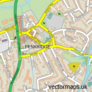
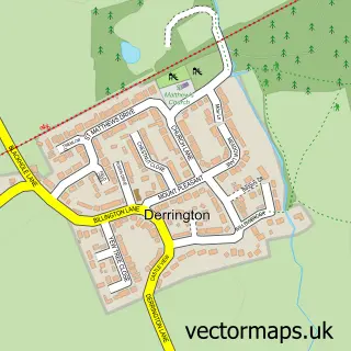
This Bradley street map is a detailed vector street map covering a 750m x 750m area. Select a larger area to create and download your own vector street map of Bradley.
The 750-metre map sample for Bradley covers 122 mapped buildings and approximately 11.1 km of road detail, of which 19 named roads are named. The immediate area includes 2 pubs and 2 MOT stations within 2 miles. The wider area around Bradley features 3 food and drink venues. To create a larger or custom map of Bradley, the map builder lets you define your own coverage area and download editable SVG, PDF and PNG files.
Create a larger editable map of Bradley
Choose any area you need and generate a high-quality vector map instantly. Perfect for print, planning, design, business and personal use.

This Bradley street map in Staffordshire is available as downloadable SVG, PDF and PNG map files, or as a printed map for planning, business, display, education, local information and design work. You can also create a larger custom map area using the map selector.
What this Bradley map sample shows
Bradley lies within Bradley Cp parish, part of Seighford & Church Eaton ward in the Stafford District (B) local authority area. The postcode geography for this area includes the ST postcode area, the ST18 postcode district and the ST18 9 postcode sector. Residents fall under the Nhs Staffordshire And Stoke-On-Trent Integrated Care Board for NHS services.
Local features near Bradley
Within 2 milesAmenities and services in and around Bradley.
Administrative and postcode information for Bradley
The local authority covering Bradley is Stafford District (B), within the county of Staffordshire. The settlement lies within Seighford & Church Eaton ward and Bradley Cp civil parish. The ST18 postcode district and ST18 9 postcode sector serve the immediate area. NHS provision in the area is delivered through University Hospitals Of North Midlands Nhs Trust.
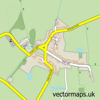
Nearby street map samples around Bradley


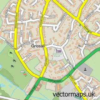
More street maps in Staffordshire
750 metre map area coverage
Boundary, postcode and point of interest information for the 750m x 750m rectangle centred on this sample map.
Boundaries containing map centre
Constituency: Stafford Co Const
County: Staffordshire County
District: Stafford District (B)
Icb: NHS Staffordshire and Stoke-on-Trent ICB
Parish: Bradley CP
Police Force: staffordshire
Postcode District: ST18
Postcode Sector: ST18 9
Ward: Seighford & Church Eaton Ward
Nearby boundaries intersecting sample
No additional intersecting boundaries found.
Postcode coverage
POI category counts
Pub: 2
Anglican Church: 1
Arts And Entertainment: 1
Car Dealer: 1
Church Cathedral: 1
Indoor Landscaping: 1
Post Office: 1
Professional Services: 1
Restaurant: 1
Town Hall: 1
Sample points of interest
- Bradley S.Mary and All Saints
- Debbie Chatfield Art
- Commercial Vehicle Procurement Ltd
- St Mary and All Saints
- Funky Yukka - Office Plants
- Bradley Post Office
- B H Holt & Sons
- Red Lion Bradley
- The Red Lion
- Wells Farm Home Deliveries
- Bradley Village Hall
Create a larger editable map of Bradley
This sample shows only a 750 metre area. To create a larger map of Bradley, use our map builder to choose your own coverage area, add titles and download editable SVG, PDF and PNG files.
Create a custom map of Bradley