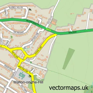
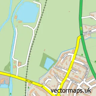
This Milford street map is a detailed vector street map covering a 750m x 750m area. Select a larger area to create and download your own vector street map of Milford.
The 750-metre map sample for Milford covers 88 mapped buildings and approximately 11.2 km of road detail, of which 5 named roads are named. The immediate area includes 2 GP surgeries within 2 miles, 2 pubs and 3 MOT stations within 2 miles. The wider area around Milford features 2 tourism points of interest and 4 food and drink venues. To create a larger or custom map of Milford, the map builder lets you define your own coverage area and download editable SVG, PDF and PNG files.
Create a larger editable map of Milford
Choose any area you need and generate a high-quality vector map instantly. Perfect for print, planning, design, business and personal use.

This Milford street map in Staffordshire is available as downloadable SVG, PDF and PNG map files, or as a printed map for planning, business, display, education, local information and design work. You can also create a larger custom map area using the map selector.
What this Milford map sample shows
Milford lies within Berkswich Cp parish, part of Milford ward in the Stafford District (B) local authority area. The postcode geography for this area includes the ST postcode area, the ST17 postcode district and the ST17 0 postcode sector. Residents fall under the Nhs Staffordshire And Stoke-On-Trent Integrated Care Board for NHS services.
Local features near Milford
Within 2 milesAmenities and services in and around Milford.
Administrative and postcode information for Milford
Milford lies within Berkswich Cp parish, part of Milford ward in the Stafford District (B) local authority area. The postcode geography for this area includes the ST postcode area, the ST17 postcode district and the ST17 0 postcode sector. Residents fall under the Nhs Staffordshire And Stoke-On-Trent Integrated Care Board for NHS services.
Nearby street map samples around Milford


More street maps in Staffordshire
750 metre map area coverage
Boundary, postcode and point of interest information for the 750m x 750m rectangle centred on this sample map.
Boundaries containing map centre
Constituency: Stone, Great Wyrley and Penkridge Co Const
County: Staffordshire County
District: Stafford District (B)
Icb: NHS Staffordshire and Stoke-on-Trent ICB
Parish: Berkswich CP
Police Force: staffordshire
Postcode District: ST17
Postcode Sector: ST17 0
Ward: Milford Ward
Nearby boundaries intersecting sample
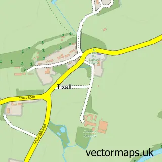
Parish: Tixall CP
Postcode District: ST18
Postcode Sector: ST18 0
Ward: Milwich Ward
Postcode coverage
POI category counts
Bicycle Shop: 3
Hair Salon: 2
Pub: 2
Arts And Entertainment: 1
Bed And Breakfast: 1
Bridge: 1
Building Supply Store: 1
Burger Restaurant: 1
Cafe: 1
Childrens Museum: 1
Sample points of interest
- Milford
- Greenfields Cottage
- Mammoth Lifestyle
- Midland Bike Fit
- Run And Ride
- Aqueduct over River Sow
- Milford Kitchens
- Wimpy UK
- Pretty Pots
- Wacky Warehouse - Barley Mow
- Classic Windows Midlands
- H. Nickolls & Son (Milford) Ltd.
Create a larger editable map of Milford
This sample shows only a 750 metre area. To create a larger map of Milford, use our map builder to choose your own coverage area, add titles and download editable SVG, PDF and PNG files.
Create a custom map of Milford