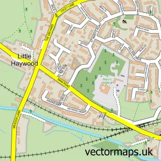
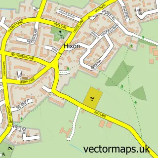
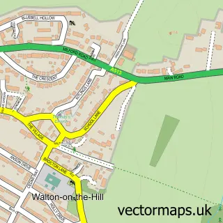
This Great Haywood street map is a detailed vector street map covering a 750m x 750m area. Select a larger area to create and download your own vector street map of Great Haywood.
The 750-metre map sample for Great Haywood covers 176 mapped buildings and approximately 16.2 km of road detail, of which 15 named roads are named. The immediate area includes 1 GP surgery within 2 miles and 4 MOT stations within 2 miles. The wider area around Great Haywood features 3 tourism points of interest. To create a larger or custom map of Great Haywood, the map builder lets you define your own coverage area and download editable SVG, PDF and PNG files.
Create a larger editable map of Great Haywood
Choose any area you need and generate a high-quality vector map instantly. Perfect for print, planning, design, business and personal use.

This Great Haywood street map in Staffordshire is available as downloadable SVG, PDF and PNG map files, or as a printed map for planning, business, display, education, local information and design work. You can also create a larger custom map area using the map selector.
What this Great Haywood map sample shows
Great Haywood lies within Colwich Cp parish, part of Haywood & Hixon ward in the Stafford District (B) local authority area. The postcode geography for this area includes the ST postcode area, the ST18 postcode district and the ST18 0 postcode sector. Residents fall under the Nhs Staffordshire And Stoke-On-Trent Integrated Care Board for NHS services.
Local features near Great Haywood
Within 2 milesAmenities and services in and around Great Haywood.
Administrative and postcode information for Great Haywood
The local authority covering Great Haywood is Stafford District (B), within the county of Staffordshire. The settlement lies within Haywood & Hixon ward and Colwich Cp civil parish. The ST18 postcode district and ST18 0 postcode sector serve the immediate area. NHS provision in the area is delivered through University Hospitals Of North Midlands Nhs Trust.
Nearby street map samples around Great Haywood
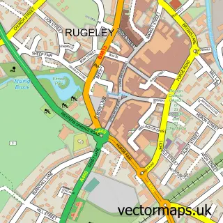

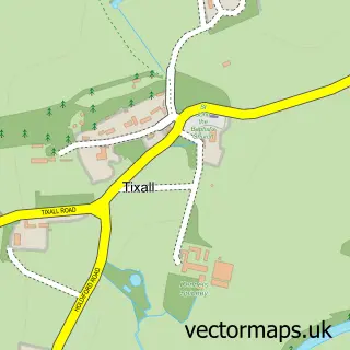
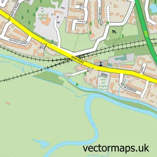
More street maps in Staffordshire
750 metre map area coverage
Boundary, postcode and point of interest information for the 750m x 750m rectangle centred on this sample map.
Boundaries containing map centre
Constituency: Stone, Great Wyrley and Penkridge Co Const
County: Staffordshire County
District: Stafford District (B)
Icb: NHS Staffordshire and Stoke-on-Trent ICB
Parish: Colwich CP
Police Force: staffordshire
Postcode District: ST18
Postcode Sector: ST18 0
Ward: Haywood & Hixon Ward
Nearby boundaries intersecting sample
No additional intersecting boundaries found.
Postcode coverage
POI category counts
Boat Service And Repair: 2
Building Supply Store: 2
Landmark And Historical Building: 2
Arts And Crafts: 1
Barber: 1
Boat Rental And Training: 1
Campground: 1
Electrician: 1
Farmers Market: 1
Financial Service: 1
Sample points of interest
- The Pottery Cave - Ceramic Studios
- Unique Hairstyles
- Anglo Welsh Great Haywood
- Great Haywood Boat Sales
- Great Haywood Marine Services Limited
- High Pressure Cleaning Services
- Matt Pearce Carpentry
- Canalside Camping
- Day and Knight
- Canalside Farm
- Xero accountants
- Great Haywood under 5s
Create a larger editable map of Great Haywood
This sample shows only a 750 metre area. To create a larger map of Great Haywood, use our map builder to choose your own coverage area, add titles and download editable SVG, PDF and PNG files.
Create a custom map of Great Haywood