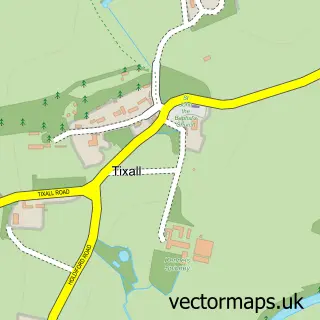
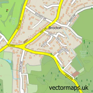
This Colwich street map is a detailed vector street map covering a 750m x 750m area. Select a larger area to create and download your own vector street map of Colwich.
The 750-metre map sample for Colwich covers 185 mapped buildings and approximately 12.3 km of road detail, of which 15 named roads are named. The immediate area includes 1 school, 1 GP surgery within 2 miles, 1 pub and 1 MOT station, with 3 within 2 miles. The wider area around Colwich features 1 food and drink venue. To create a larger or custom map of Colwich, the map builder lets you define your own coverage area and download editable SVG, PDF and PNG files.
Create a larger editable map of Colwich
Choose any area you need and generate a high-quality vector map instantly. Perfect for print, planning, design, business and personal use.

This Colwich street map in Staffordshire is available as downloadable SVG, PDF and PNG map files, or as a printed map for planning, business, display, education, local information and design work. You can also create a larger custom map area using the map selector.
What this Colwich map sample shows
Colwich lies within Colwich Cp parish, part of Haywood & Hixon ward in the Stafford District (B) local authority area. The postcode geography for this area includes the ST postcode area, the ST18 postcode district and the ST18 0 postcode sector. Residents fall under the Nhs Staffordshire And Stoke-On-Trent Integrated Care Board for NHS services.
Local features near Colwich
Within 2 milesAmenities and services in and around Colwich.
Administrative and postcode information for Colwich
Colwich lies within Colwich Cp parish, part of Haywood & Hixon ward in the Stafford District (B) local authority area. The postcode geography for this area includes the ST postcode area, the ST18 postcode district and the ST18 0 postcode sector. Residents fall under the Nhs Staffordshire And Stoke-On-Trent Integrated Care Board for NHS services.
Nearby street map samples around Colwich
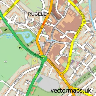

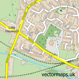
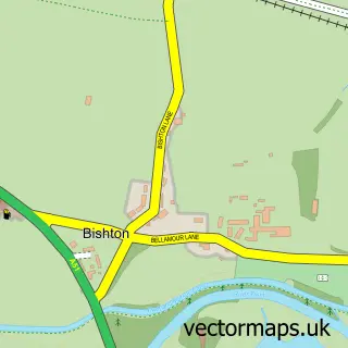
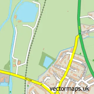
More street maps in Staffordshire
750 metre map area coverage
Boundary, postcode and point of interest information for the 750m x 750m rectangle centred on this sample map.
Boundaries containing map centre
Constituency: Stone, Great Wyrley and Penkridge Co Const
County: Staffordshire County
District: Stafford District (B)
Icb: NHS Staffordshire and Stoke-on-Trent ICB
Parish: Colwich CP
Police Force: staffordshire
Postcode District: ST17
Postcode Sector: ST17 0
Ward: Haywood & Hixon Ward
Nearby boundaries intersecting sample
Postcode District: ST18
Postcode Sector: ST18 0
Postcode coverage
POI category counts
Hair Salon: 2
Preschool: 2
Arts And Entertainment: 1
Beauty Salon: 1
Building Supply Store: 1
Bus Station: 1
Canal: 1
Car Rental Agency: 1
Church Cathedral: 1
Community Center: 1
Sample points of interest
- Colwich
- Sophie Elizabeth - Brows Bridal Beauty
- Haywood Heating & Plumbing Services
- St. Michael And All Angels' Church
- Colwich Lock
- Humbers Tourer Hire
- St Michael and All Angels' Church Colwich
- Colwich & Little Haywood Village Hall
- St Mary's Abbey (Benedictines of Mary, Queen of Apostles)
- S C I
- Colwich Primary School
- Little Haywood Village Hall
Create a larger editable map of Colwich
This sample shows only a 750 metre area. To create a larger map of Colwich, use our map builder to choose your own coverage area, add titles and download editable SVG, PDF and PNG files.
Create a custom map of Colwich