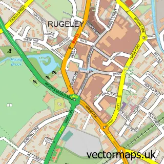
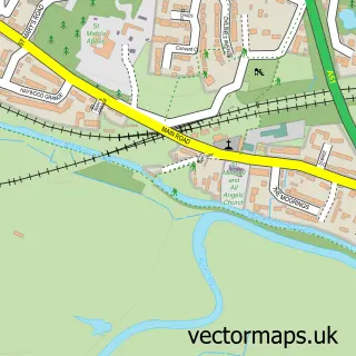
This Slitting Mill street map is a detailed vector street map covering a 750m x 750m area. Select a larger area to create and download your own vector street map of Slitting Mill.
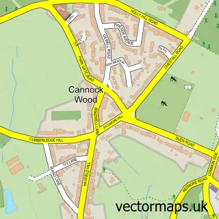
The 750-metre map sample for Slitting Mill covers 140 mapped buildings and approximately 12.0 km of road detail, of which 12 named roads are named. The immediate area includes 4 GP surgeries within 2 miles, 1 pub and 13 MOT stations within 2 miles. The wider area around Slitting Mill features 1 food and drink venue and 2 campsites within 2 miles. To create a larger or custom map of Slitting Mill, the map builder lets you define your own coverage area and download editable SVG, PDF and PNG files.
Create a larger editable map of Slitting Mill
Choose any area you need and generate a high-quality vector map instantly. Perfect for print, planning, design, business and personal use.

This Slitting Mill street map in Staffordshire is available as downloadable SVG, PDF and PNG map files, or as a printed map for planning, business, display, education, local information and design work. You can also create a larger custom map area using the map selector.
What this Slitting Mill map sample shows
Slitting Mill lies within Rugeley Cp parish, part of Etching Hill And The Heath ward in the Cannock Chase District local authority area. The postcode geography for this area includes the WS postcode area, the WS15 postcode district and the WS15 2 postcode sector. Residents fall under the Nhs Staffordshire And Stoke-On-Trent Integrated Care Board for NHS services.
Local features near Slitting Mill
Within 2 milesAmenities and services in and around Slitting Mill.
Administrative and postcode information for Slitting Mill
Slitting Mill lies within Rugeley Cp parish, part of Etching Hill And The Heath ward in the Cannock Chase District local authority area. The postcode geography for this area includes the WS postcode area, the WS15 postcode district and the WS15 2 postcode sector. Residents fall under the Nhs Staffordshire And Stoke-On-Trent Integrated Care Board for NHS services.
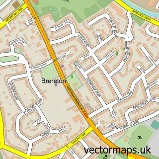
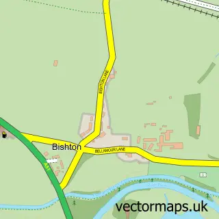
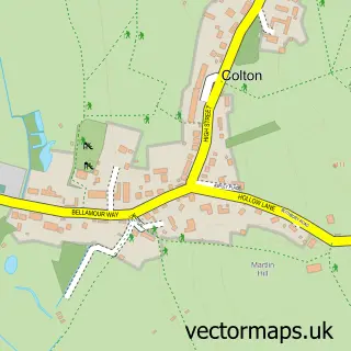
Nearby street map samples around Slitting Mill

More street maps in Staffordshire
750 metre map area coverage
Boundary, postcode and point of interest information for the 750m x 750m rectangle centred on this sample map.
Boundaries containing map centre
Constituency: Cannock Chase Co Const
County: Staffordshire County
District: Cannock Chase District
Icb: NHS Staffordshire and Stoke-on-Trent ICB
Parish: Rugeley CP
Police Force: staffordshire
Postcode District: WS15
Postcode Sector: WS15 2
Ward: Etching Hill & the Heath Ward
Nearby boundaries intersecting sample
Ward: Western Springs Ward
Postcode coverage
POI category counts
Anglican Church: 1
Auto Electrical Repair: 1
Beauty Salon: 1
Community Center: 1
Construction Services: 1
Electrician: 1
Fishing Club: 1
Hvac Services: 1
Landscaping: 1
Pub: 1
Sample points of interest
- St John the Baptist, Slitting Mill - FORMALLY CLOSED in 2025
- L J W Air Conditioning Ltd.
- Bianca Reiss Hair & Beauty
- Slitting Mill Victory Hall
- ICAD Developments
- Rugeley Electrical
- Horns Pool Fishery
- LJW Air Conditioning
- Parkes Quality Landscaping Services
- The Horns Inn
- Fair Oak Business and Enterprise College
Create a larger editable map of Slitting Mill
This sample shows only a 750 metre area. To create a larger map of Slitting Mill, use our map builder to choose your own coverage area, add titles and download editable SVG, PDF and PNG files.
Create a custom map of Slitting Mill