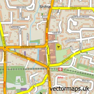
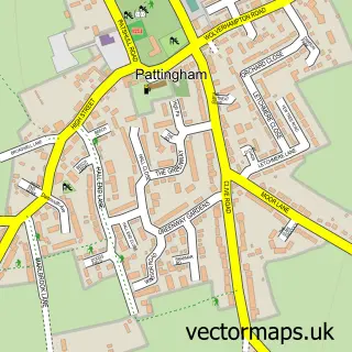
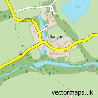
This Albrighton street map is a detailed vector street map covering a 750m x 750m area. Select a larger area to create and download your own vector street map of Albrighton.
The 750-metre map sample for Albrighton covers 421 mapped buildings and approximately 18.6 km of road detail, of which 37 named roads are named. The immediate area includes 1 school, 1 GP surgery within 2 miles, 6 pubs and 2 MOT stations. The wider area around Albrighton features 1 tourism point of interest and 16 food and drink venues. To create a larger or custom map of Albrighton, the map builder lets you define your own coverage area and download editable SVG, PDF and PNG files.
Create a larger editable map of Albrighton
Choose any area you need and generate a high-quality vector map instantly. Perfect for print, planning, design, business and personal use.

This Albrighton street map in Shropshire is available as downloadable SVG, PDF and PNG map files, or as a printed map for planning, business, display, education, local information and design work. You can also create a larger custom map area using the map selector.
What this Albrighton map sample shows
Albrighton lies within Albrighton Cp parish, part of Albrighton ward in the Shropshire local authority area. The postcode geography for this area includes the WV postcode area, the WV7 postcode district and the WV7 3 postcode sector. Residents fall under the Nhs Shropshire, Telford And Wrekin Integrated Care Board for NHS services.
Local features near Albrighton
Within 2 milesAmenities and services in and around Albrighton.
Administrative and postcode information for Albrighton
Albrighton lies within Albrighton Cp parish, part of Albrighton ward in the Shropshire local authority area. The postcode geography for this area includes the WV postcode area, the WV7 postcode district and the WV7 3 postcode sector. Residents fall under the Nhs Shropshire, Telford And Wrekin Integrated Care Board for NHS services.
Nearby street map samples around Albrighton

More street maps in Shropshire
750 metre map area coverage
Boundary, postcode and point of interest information for the 750m x 750m rectangle centred on this sample map.
Boundaries containing map centre
Constituency: The Wrekin Co Const
District: Shropshire
Icb: NHS Shropshire Telford and Wrekin ICB
Parish: Albrighton and Donington CP
Police Force: west mercia
Postcode District: WV7
Postcode Sector: WV7 3
Nearby boundaries intersecting sample
No additional intersecting boundaries found.
Postcode coverage
POI category counts
Flowers And Gifts Shop: 6
Hair Salon: 6
Pub: 6
Beauty Salon: 5
Cafe: 5
Convenience Store: 5
Banks: 4
Beauty And Spa: 4
Antique Store: 3
Bar: 3
Sample points of interest
- Balance Health & Beauty Care
- St. Mary Magdalene, Albrighton
- Arnold Davies
- Compton Hospice Shop
- Nauticality Nautical Gifts
- Garage Gallery
- PayPoint
- Keith Gibson Cars Ltd
- Albrighton Garage
- Barclays
- Lloyds Bank
- TSB
Create a larger editable map of Albrighton
This sample shows only a 750 metre area. To create a larger map of Albrighton, use our map builder to choose your own coverage area, add titles and download editable SVG, PDF and PNG files.
Create a custom map of Albrighton