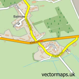
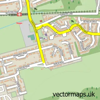
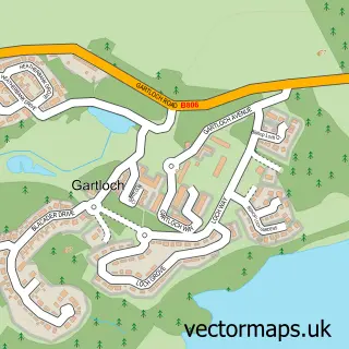
This Bishopbriggs street map is a detailed vector street map covering a 750m x 750m area. Select a larger area to create and download your own vector street map of Bishopbriggs.
The 750-metre map sample for Bishopbriggs covers 411 mapped buildings and approximately 20.6 km of road detail, of which 36 named roads are named. The immediate area includes 1 railway station, 3 GP surgeries, with 17 within 2 miles, 2 pubs and 2 MOT stations, with 17 within 2 miles. The wider area around Bishopbriggs features 10 food and drink venues. To create a larger or custom map of Bishopbriggs, the map builder lets you define your own coverage area and download editable SVG, PDF and PNG files.
Create a larger editable map of Bishopbriggs
Choose any area you need and generate a high-quality vector map instantly. Perfect for print, planning, design, business and personal use.

This Bishopbriggs street map in Dunbartonshire is available as downloadable SVG, PDF and PNG map files, or as a printed map for planning, business, display, education, local information and design work. You can also create a larger custom map area using the map selector.
What this Bishopbriggs map sample shows
Bishopbriggs lies within East Dunbartonshire parish, part of Bishopbriggs South ward in the East Dunbartonshire local authority area. The postcode geography for this area includes the G postcode area, the G64 postcode district and the G64 2 postcode sector. Residents fall under the Greater Glasgow And Clyde for NHS services.
Local features near Bishopbriggs
Within 2 milesAmenities and services in and around Bishopbriggs.
Administrative and postcode information for Bishopbriggs
Bishopbriggs lies within East Dunbartonshire parish, part of Bishopbriggs South ward in the East Dunbartonshire local authority area. The postcode geography for this area includes the G postcode area, the G64 postcode district and the G64 2 postcode sector. Residents fall under the Greater Glasgow And Clyde for NHS services.
Nearby street map samples around Bishopbriggs

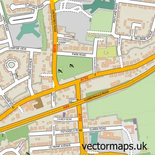
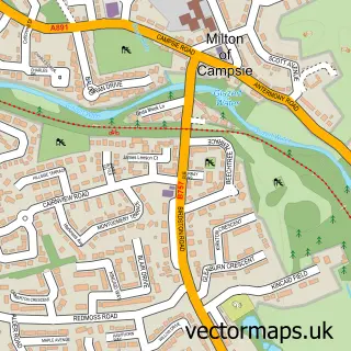
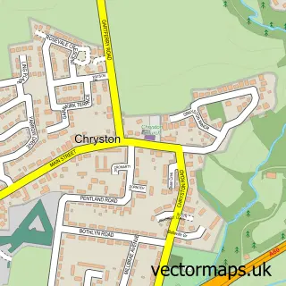
More street maps in Dunbartonshire
750 metre map area coverage
Boundary, postcode and point of interest information for the 750m x 750m rectangle centred on this sample map.
Boundaries containing map centre
Constituency: Mid Dunbartonshire Co Const
District: East Dunbartonshire
Icb: Greater Glasgow and Clyde
Postcode District: G64
Postcode Sector: G64 2
Ward: Bishopbriggs North and Campsie Ward
Nearby boundaries intersecting sample
Postcode Sector: G64 1, G64 3
Ward: Bishopbriggs South Ward
Postcode coverage
POI category counts
Beauty Salon: 10
Pharmacy: 6
Automotive Repair: 5
Gym: 5
Coffee Shop: 4
Dentist: 4
Restaurant: 4
Bakery: 3
Bank Credit Union: 3
Banks: 3
Sample points of interest
- East Dunbartonshire T.O.A
- Coogan Architects
- ARNOLD CLARK BISHOPBRIGGS
- Briggs Motors Ltd
- Car Fix Direct
- Crowhill Motors
- Kwik Fit
- Bob the P C Builder
- FRESH Bakery
- Thomas Auld & Sons
- Wish Upon A Cake
- Bank of Scotland
Create a larger editable map of Bishopbriggs
This sample shows only a 750 metre area. To create a larger map of Bishopbriggs, use our map builder to choose your own coverage area, add titles and download editable SVG, PDF and PNG files.
Create a custom map of Bishopbriggs