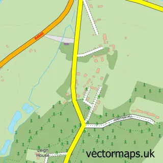
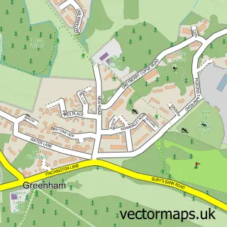
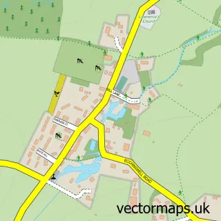
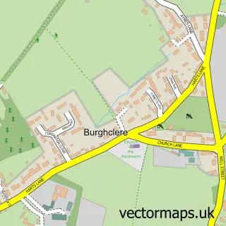
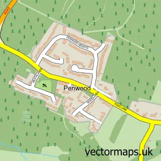
This Bishops Green street map is a detailed vector street map covering a 750m x 750m area. Select a larger area to create and download your own vector street map of Bishops Green.
The 750-metre map sample for Bishops Green covers 104 mapped buildings and approximately 10.0 km of road detail, of which 11 named roads are named. The immediate area includes 3 MOT stations within 2 miles. The wider area around Bishops Green features 2 tourism points of interest and 1 campsite within 2 miles. To create a larger or custom map of Bishops Green, the map builder lets you define your own coverage area and download editable SVG, PDF and PNG files.
Create a larger editable map of Bishops Green
Choose any area you need and generate a high-quality vector map instantly. Perfect for print, planning, design, business and personal use.

This Bishops Green street map in Hampshire is available as downloadable SVG, PDF and PNG map files, or as a printed map for planning, business, display, education, local information and design work. You can also create a larger custom map area using the map selector.
What this Bishops Green map sample shows
Bishops Green lies within Greenham Cp parish, part of Newbury Greenham ward in the West Berkshire local authority area. The postcode geography for this area includes the RG postcode area, the RG20 postcode district and the RG20 4 postcode sector. Residents fall under the Nhs Buckinghamshire, Oxfordshire And Berkshire West Integrated Care Board for NHS services.
Local features near Bishops Green
Within 2 milesAmenities and services in and around Bishops Green.
Administrative and postcode information for Bishops Green
Bishops Green lies within Greenham Cp parish, part of Newbury Greenham ward in the West Berkshire local authority area. The postcode geography for this area includes the RG postcode area, the RG20 postcode district and the RG20 4 postcode sector. Residents fall under the Nhs Buckinghamshire, Oxfordshire And Berkshire West Integrated Care Board for NHS services.
Nearby street map samples around Bishops Green

More street maps in Hampshire
750 metre map area coverage
Boundary, postcode and point of interest information for the 750m x 750m rectangle centred on this sample map.
Boundaries containing map centre
Constituency: North West Hampshire Co Const
County: Hampshire County
District: Basingstoke and Deane District (B)
Icb: NHS Hampshire and Isle of Wight ICB
Parish: Ecchinswell, Sydmonton and Bishops Green CP
Police Force: hampshire
Postcode District: RG20
Postcode Sector: RG20 4
Ward: Evingar Ward
Nearby boundaries intersecting sample
No additional intersecting boundaries found.
Postcode coverage
POI category counts
Automotive Repair: 2
Community Services Non Profits: 2
Professional Services: 2
Auction House: 1
Beauty Salon: 1
Campground: 1
Contractor: 1
Convenience Store: 1
Courier And Delivery Services: 1
Financial Advising: 1
Sample points of interest
- Special Auction Services
- G.P.R Guitar Repair
- Hsd Electrics
- Lady A Aesthetics
- Bishops Green Farm Campsite
- Bishops Green Community Association and Village Hall
- Ecchinswell Bell Restoration Trust
- JS Fencing and Landscaping
- Ashland Store
- Evri ParcelShop
- All Aspects Financial - Newbury IFA
- Bishop's Green
Create a larger editable map of Bishops Green
This sample shows only a 750 metre area. To create a larger map of Bishops Green, use our map builder to choose your own coverage area, add titles and download editable SVG, PDF and PNG files.
Create a custom map of Bishops Green