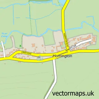
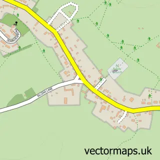
This Bishopstone street map is a detailed vector street map covering a 750m x 750m area. Select a larger area to create and download your own vector street map of Bishopstone.
The 750-metre map sample for Bishopstone covers 147 mapped buildings and approximately 9.8 km of road detail, of which 15 named roads are named. The immediate area includes 2 pubs. The wider area around Bishopstone features 2 food and drink venues. To create a larger or custom map of Bishopstone, the map builder lets you define your own coverage area and download editable SVG, PDF and PNG files.
Create a larger editable map of Bishopstone
Choose any area you need and generate a high-quality vector map instantly. Perfect for print, planning, design, business and personal use.

This Bishopstone street map in Wiltshire is available as downloadable SVG, PDF and PNG map files, or as a printed map for planning, business, display, education, local information and design work. You can also create a larger custom map area using the map selector.
What this Bishopstone map sample shows
Bishopstone lies within Bishopstone Cp parish, part of Fovant And Chalke Valley ward in the Wiltshire local authority area. The postcode geography for this area includes the SP postcode area, the SP5 postcode district and the SP5 4 postcode sector. Residents fall under the Nhs Bath And North East Somerset, Swindon And Wiltshire Integrated Care Board for NHS services.
Local features near Bishopstone
Within 2 milesAmenities and services in and around Bishopstone.
Administrative and postcode information for Bishopstone
The local authority covering Bishopstone is Wiltshire, within the county of Wiltshire. The settlement lies within Fovant And Chalke Valley ward and Bishopstone Cp civil parish. The SP5 postcode district and SP5 4 postcode sector serve the immediate area. NHS provision in the area is delivered through Salisbury Nhs Foundation Trust.
Nearby street map samples around Bishopstone

More street maps in Wiltshire
750 metre map area coverage
Boundary, postcode and point of interest information for the 750m x 750m rectangle centred on this sample map.
Boundaries containing map centre
Constituency: Salisbury Co Const
District: Wiltshire
Icb: NHS Bath and North East Somerset Swindon and Wiltshire ICB
Parish: Bishopstone CP
Police Force: wiltshire
Postcode District: SP5
Postcode Sector: SP5 4
Nearby boundaries intersecting sample
No additional intersecting boundaries found.
Postcode coverage
POI category counts
Pub: 2
Beauty And Spa: 1
Chimney Sweep: 1
Parking: 1
Personal Care Service: 1
Pet Boarding: 1
Photography Store And Services: 1
Professional Services: 1
Tile Store: 1
Town Hall: 1
Sample points of interest
- Chalke Valley Soaps
- Complete Sweep
- Robin Higdon Motors
- 101 Friends for Every Dog
- Dan & Co. Home Boarding For Dogs
- Leoness Photography
- Leoness Photography
- The White Hart
- White Hart Bishopstone
- Salisbury Wood Floors Ltd.
- Bishopstone Village Hall
Create a larger editable map of Bishopstone
This sample shows only a 750 metre area. To create a larger map of Bishopstone, use our map builder to choose your own coverage area, add titles and download editable SVG, PDF and PNG files.
Create a custom map of Bishopstone