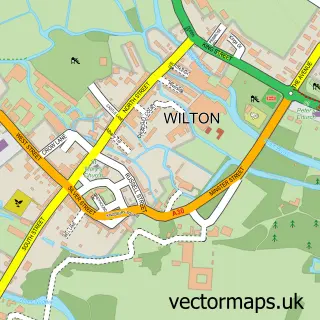
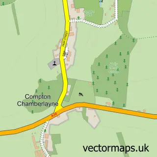
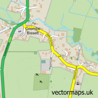
This Burcombe street map is a detailed vector street map covering a 750m x 750m area. Select a larger area to create and download your own vector street map of Burcombe.
The 750-metre map sample for Burcombe covers 58 mapped buildings and approximately 7.6 km of road detail. The immediate area includes 1 GP surgery within 2 miles, 1 pub and 1 MOT station within 2 miles. The wider area around Burcombe features 1 tourism point of interest and 1 food and drink venue. To create a larger or custom map of Burcombe, the map builder lets you define your own coverage area and download editable SVG, PDF and PNG files.
Create a larger editable map of Burcombe
Choose any area you need and generate a high-quality vector map instantly. Perfect for print, planning, design, business and personal use.

This Burcombe street map in Wiltshire is available as downloadable SVG, PDF and PNG map files, or as a printed map for planning, business, display, education, local information and design work. You can also create a larger custom map area using the map selector.
What this Burcombe map sample shows
Burcombe lies within Burcombe Without Cp parish, part of Nadder And East Knoyle ward in the Wiltshire local authority area. The postcode geography for this area includes the SP postcode area, the SP2 postcode district and the SP2 0 postcode sector. Residents fall under the Nhs Bath And North East Somerset, Swindon And Wiltshire Integrated Care Board for NHS services.
Local features near Burcombe
Within 2 milesAmenities and services in and around Burcombe.
Administrative and postcode information for Burcombe
Burcombe lies within Burcombe Without Cp parish, part of Nadder And East Knoyle ward in the Wiltshire local authority area. The postcode geography for this area includes the SP postcode area, the SP2 postcode district and the SP2 0 postcode sector. Residents fall under the Nhs Bath And North East Somerset, Swindon And Wiltshire Integrated Care Board for NHS services.
Nearby street map samples around Burcombe

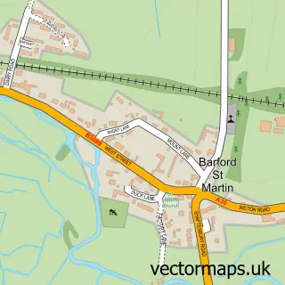
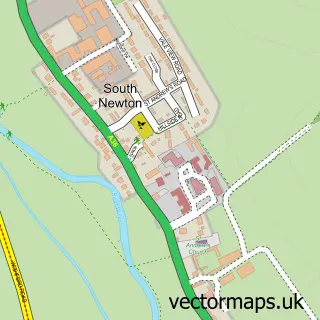
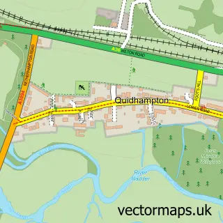
More street maps in Wiltshire
750 metre map area coverage
Boundary, postcode and point of interest information for the 750m x 750m rectangle centred on this sample map.
Boundaries containing map centre
Constituency: Salisbury Co Const
District: Wiltshire
Icb: NHS Bath and North East Somerset Swindon and Wiltshire ICB
Parish: Burcombe Without CP
Police Force: wiltshire
Postcode District: SP2
Postcode Sector: SP2 0
Nearby boundaries intersecting sample
Parish: Barford St. Martin CP
Postcode District: SP3
Postcode Sector: SP3 4
Postcode coverage
POI category counts
Agricultural Service: 1
Architectural Designer: 1
Bed And Breakfast: 1
Business Management Services: 1
Butcher Shop: 1
Employment Agencies: 1
Italian Restaurant: 1
Landmark And Historical Building: 1
Printing Services: 1
Pub: 1
Sample points of interest
- Bright Seeds
- Michael Lyons Architecture
- Burcombe Manor
- D&N Construction (Salisbury)
- Manor Farm Butchers Ltd
- ReQuire Consultancy
- Villa Verde Wilton
- Burcombe
- WildFish
- The Ship Inn
Create a larger editable map of Burcombe
This sample shows only a 750 metre area. To create a larger map of Burcombe, use our map builder to choose your own coverage area, add titles and download editable SVG, PDF and PNG files.
Create a custom map of Burcombe