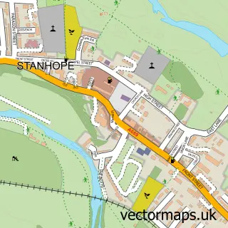
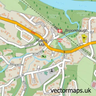
This Blanchland street map is a detailed vector street map covering a 750m x 750m area. Select a larger area to create and download your own vector street map of Blanchland.
The 750-metre map sample for Blanchland covers 41 mapped buildings and approximately 15.4 km of road detail, of which 3 named roads are named. The wider area around Blanchland features 1 hotel. To create a larger or custom map of Blanchland, the map builder lets you define your own coverage area and download editable SVG, PDF and PNG files.
Create a larger editable map of Blanchland
Choose any area you need and generate a high-quality vector map instantly. Perfect for print, planning, design, business and personal use.

This Blanchland street map in Northumberland is available as downloadable SVG, PDF and PNG map files, or as a printed map for planning, business, display, education, local information and design work. You can also create a larger custom map area using the map selector.
What this Blanchland map sample shows
Blanchland lies within Blanchland Cp parish, part of South Tynedale ward in the Northumberland local authority area. The postcode geography for this area includes the DH postcode area, the DH8 postcode district and the DH8 9 postcode sector. Residents fall under the Nhs North East And North Cumbria Integrated Care Board for NHS services.
Local features near Blanchland
Within 2 milesAmenities and services in and around Blanchland.
Administrative and postcode information for Blanchland
The local authority covering Blanchland is Northumberland, within the county of Northumberland. The settlement lies within South Tynedale ward and Blanchland Cp civil parish. The DH8 postcode district and DH8 9 postcode sector serve the immediate area. NHS provision in the area is delivered through Northumbria Healthcare Nhs Foundation Trust.
Nearby street map samples around Blanchland

More street maps in Northumberland
750 metre map area coverage
Boundary, postcode and point of interest information for the 750m x 750m rectangle centred on this sample map.
Boundaries containing map centre
Constituency: Hexham Co Const
District: Northumberland
Icb: NHS North East and North Cumbria ICB
Parish: Blanchland CP
Police Force: northumberland
Postcode District: DH8
Postcode Sector: DH8 9
Nearby boundaries intersecting sample
Constituency: Bishop Auckland Co Const
District: County Durham
Parish: Hunstanworth CP
Police Force: durham
Postcode coverage
POI category counts
Art Gallery: 2
Anglican Church: 1
Arts And Crafts: 1
Boat Rental And Training: 1
Church Cathedral: 1
Ev Charging Station: 1
Flowers And Gifts Shop: 1
Hotel: 1
Post Office: 1
Sports Club And League: 1
Sample points of interest
- Blanchland Abbey
- Gallery Upstairs
- Lamb, G
- Beyond the Byre Jewellery
- Derwent Reservoir Sailing Club
- Blanchland Abbey
- The Lord Crewe Arms
- Jaspah Crewe
- Lord Crewe Arms Blanchland
- Blanchland Post Office
- Blanchland Sports Club
- The White Monk Tearoom
Create a larger editable map of Blanchland
This sample shows only a 750 metre area. To create a larger map of Blanchland, use our map builder to choose your own coverage area, add titles and download editable SVG, PDF and PNG files.
Create a custom map of Blanchland