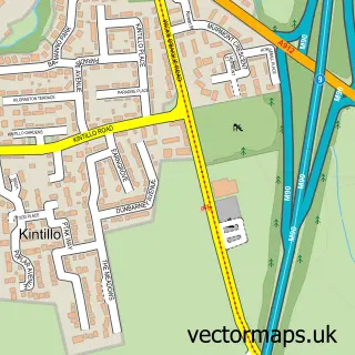
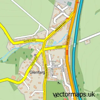
This Bridge of Earn street map is a detailed vector street map covering a 750m x 750m area. Select a larger area to create and download your own vector street map of Bridge of Earn.
The 750-metre map sample for Bridge of Earn covers 241 mapped buildings and approximately 10.9 km of road detail, of which 21 named roads are named. The immediate area includes 2 pubs and 1 MOT station, with 2 within 2 miles. The wider area around Bridge of Earn features 1 tourism point of interest, 3 food and drink venues and 3 hotels. To create a larger or custom map of Bridge of Earn, the map builder lets you define your own coverage area and download editable SVG, PDF and PNG files.
Create a larger editable map of Bridge of Earn
Choose any area you need and generate a high-quality vector map instantly. Perfect for print, planning, design, business and personal use.

This Bridge of Earn street map in Perth and Kinross is available as downloadable SVG, PDF and PNG map files, or as a printed map for planning, business, display, education, local information and design work. You can also create a larger custom map area using the map selector.
What this Bridge of Earn map sample shows
Bridge of Earn lies within Perth And Kinross parish, part of Almond And Earn ward in the Perth And Kinross local authority area. The postcode geography for this area includes the PH postcode area, the PH2 postcode district and the PH2 9 postcode sector. Residents fall under the Tayside for NHS services.
Local features near Bridge of Earn
Within 2 milesAmenities and services in and around Bridge of Earn.
Administrative and postcode information for Bridge of Earn
The local authority covering Bridge of Earn is Perth And Kinross, within the county of Perth And Kinross. The settlement lies within Almond And Earn ward and Perth And Kinross civil parish. The PH2 postcode district and PH2 9 postcode sector serve the immediate area. NHS provision in the area is delivered through Tayside.
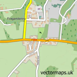
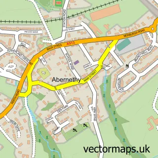
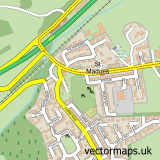
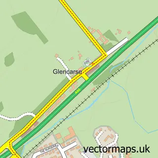
Nearby street map samples around Bridge of Earn

More street maps in Perth and Kinross
750 metre map area coverage
Boundary, postcode and point of interest information for the 750m x 750m rectangle centred on this sample map.
Boundaries containing map centre
Constituency: Perth and Kinross-shire Co Const
District: Perth and Kinross
Icb: Tayside
Postcode District: PH2
Postcode Sector: PH2 9
Ward: Almond and Earn Ward
Nearby boundaries intersecting sample
Postcode Sector: PH2 8
Postcode coverage
POI category counts
Hair Salon: 3
Hotel: 3
Bakery: 2
Beauty Salon: 2
Pub: 2
Used Car Dealer: 2
American Restaurant: 1
Art School: 1
Atms: 1
Auto Body Shop: 1
Sample points of interest
- Pine Cone Point the Hermitage Dunkeld
- Barry Allan Scott Fine Art
- The Cooperative Food Bridge of Earn - Main Street New, Bridge of Earn
- Smart Repairs
- I Dreamed A Cake.....
- Tower Bakery
- Balance Beauty Room
- Beam and Beauty
- Elaine's Beautique
- Birch Villa B&B
- Dunbarney and Forgandenny Parish Church
- Bridge of Earn Baby & Toddler Group
Create a larger editable map of Bridge of Earn
This sample shows only a 750 metre area. To create a larger map of Bridge of Earn, use our map builder to choose your own coverage area, add titles and download editable SVG, PDF and PNG files.
Create a custom map of Bridge of Earn