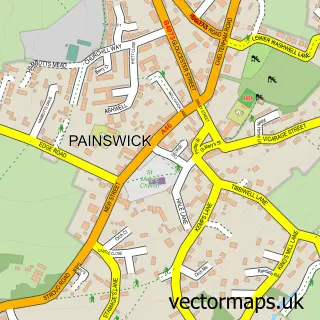
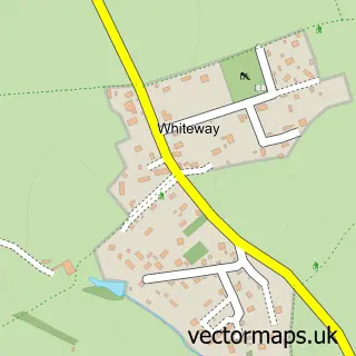
This Brimpsfield street map is a detailed vector street map covering a 750m x 750m area. Select a larger area to create and download your own vector street map of Brimpsfield.
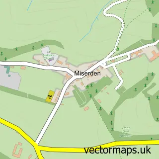
The 750-metre map sample for Brimpsfield covers 83 mapped buildings and approximately 20.4 km of road detail. The wider area around Brimpsfield features 1 tourism point of interest. To create a larger or custom map of Brimpsfield, the map builder lets you define your own coverage area and download editable SVG, PDF and PNG files.
Create a larger editable map of Brimpsfield
Choose any area you need and generate a high-quality vector map instantly. Perfect for print, planning, design, business and personal use.

This Brimpsfield street map in Gloucestershire is available as downloadable SVG, PDF and PNG map files, or as a printed map for planning, business, display, education, local information and design work. You can also create a larger custom map area using the map selector.
What this Brimpsfield map sample shows
Brimpsfield lies within Brimpsfield Cp parish, part of Ermin ward in the Cotswold District local authority area. The postcode geography for this area includes the GL postcode area, the GL4 postcode district and the GL4 8 postcode sector. Residents fall under the Nhs Gloucestershire Integrated Care Board for NHS services.
Local features near Brimpsfield
Within 2 milesAmenities and services in and around Brimpsfield.
Administrative and postcode information for Brimpsfield
The local authority covering Brimpsfield is Cotswold District, within the county of Gloucestershire. The settlement lies within Ermin ward and Brimpsfield Cp civil parish. The GL4 postcode district and GL4 8 postcode sector serve the immediate area. NHS provision in the area is delivered through Gloucestershire Hospitals Nhs Foundation Trust.
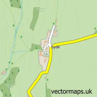
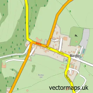
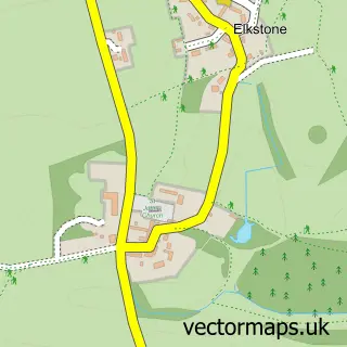
Nearby street map samples around Brimpsfield

More street maps in Gloucestershire
750 metre map area coverage
Boundary, postcode and point of interest information for the 750m x 750m rectangle centred on this sample map.
Boundaries containing map centre
Constituency: North Cotswolds Co Const
County: Gloucestershire County
District: Cotswold District
Icb: NHS Gloucestershire ICB
Parish: Brimpsfield CP
Police Force: gloucestershire
Postcode District: GL4
Postcode Sector: GL4 8
Ward: Ermin Ward
Nearby boundaries intersecting sample
No additional intersecting boundaries found.
Postcode coverage
POI category counts
Anglican Church: 1
Bed And Breakfast: 1
Building Supply Store: 1
Car Rental Agency: 1
Community Center: 1
Employment Agencies: 1
Gift Shop: 1
It Service And Computer Repair: 1
Landmark And Historical Building: 1
Outdoor Gear: 1
Sample points of interest
- Brimpsfield St Michael & All Angels
- Rowanstone BnB
- The Cotswold Gardening Co
- Classic Motoring
- Brimpsfield Village Hall
- Corinium
- The Cheltenham Hamper Co
- Alpha Plus Guardian Services
- Brimpsfield Priory
- Classic Motoring
Create a larger editable map of Brimpsfield
This sample shows only a 750 metre area. To create a larger map of Brimpsfield, use our map builder to choose your own coverage area, add titles and download editable SVG, PDF and PNG files.
Create a custom map of Brimpsfield