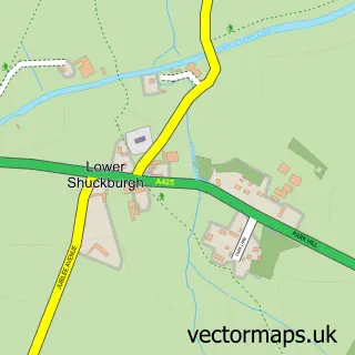
This Broadwell street map is a detailed vector street map covering a 750m x 750m area. Select a larger area to create and download your own vector street map of Broadwell.
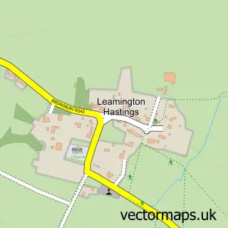
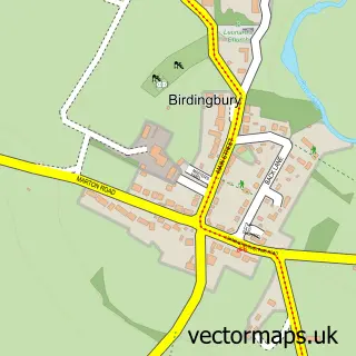
The 750-metre map sample for Broadwell covers 108 mapped buildings and approximately 10.4 km of road detail, of which 1 named road are named. The wider area around Broadwell features 1 campsite within 2 miles. To create a larger or custom map of Broadwell, the map builder lets you define your own coverage area and download editable SVG, PDF and PNG files.
Create a larger editable map of Broadwell
Choose any area you need and generate a high-quality vector map instantly. Perfect for print, planning, design, business and personal use.

This Broadwell street map in Warwickshire is available as downloadable SVG, PDF and PNG map files, or as a printed map for planning, business, display, education, local information and design work. You can also create a larger custom map area using the map selector.
What this Broadwell map sample shows
Broadwell lies within Leamington Hastings Cp parish, part of Leam Valley ward in the Rugby District (B) local authority area. The postcode geography for this area includes the CV postcode area, the CV23 postcode district and the CV23 8 postcode sector. Residents fall under the Nhs Coventry And Warwickshire Integrated Care Board for NHS services.
Local features near Broadwell
Within 2 milesAmenities and services in and around Broadwell.
Administrative and postcode information for Broadwell
Broadwell lies within Leamington Hastings Cp parish, part of Leam Valley ward in the Rugby District (B) local authority area. The postcode geography for this area includes the CV postcode area, the CV23 postcode district and the CV23 8 postcode sector. Residents fall under the Nhs Coventry And Warwickshire Integrated Care Board for NHS services.
Nearby street map samples around Broadwell

More street maps in Warwickshire
750 metre map area coverage
Boundary, postcode and point of interest information for the 750m x 750m rectangle centred on this sample map.
Boundaries containing map centre
Constituency: Kenilworth and Southam Co Const
County: Warwickshire County
District: Rugby District (B)
Icb: NHS Coventry and Warwickshire ICB
Parish: Leamington Hastings CP
Police Force: warwickshire
Postcode District: CV23
Postcode Sector: CV23 8
Ward: Leam Valley Ward
Nearby boundaries intersecting sample
No additional intersecting boundaries found.
Postcode coverage
POI category counts
Business Management Services: 1
Cleaning Services: 1
Community Center: 1
Contractor: 1
Flowers And Gifts Shop: 1
Freight And Cargo Service: 1
Plasterer: 1
Professional Services: 1
Sample points of interest
- Cedar + Co. Group Ltd.
- IEC Industrial & Environmental Cleaning
- Broadwell Victory Hall
- Traditional Plastering Co
- The Melanie Webb Flower School
- G Whitehall
- Traditional Plastering Co.
- Raymont-Osman Product Design
Create a larger editable map of Broadwell
This sample shows only a 750 metre area. To create a larger map of Broadwell, use our map builder to choose your own coverage area, add titles and download editable SVG, PDF and PNG files.
Create a custom map of Broadwell