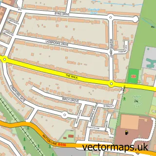
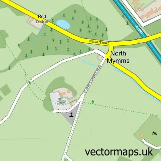
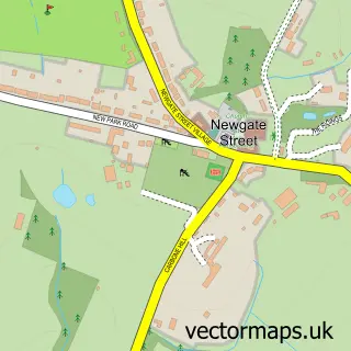
This Brookmans Park street map is a detailed vector street map covering a 750m x 750m area. Select a larger area to create and download your own vector street map of Brookmans Park.
The 750-metre map sample for Brookmans Park covers 212 mapped buildings and approximately 9.7 km of road detail, of which 9 named roads are named. The immediate area includes 4 GP surgeries within 2 miles and 7 MOT stations within 2 miles. To create a larger or custom map of Brookmans Park, the map builder lets you define your own coverage area and download editable SVG, PDF and PNG files.
Create a larger editable map of Brookmans Park
Choose any area you need and generate a high-quality vector map instantly. Perfect for print, planning, design, business and personal use.

This Brookmans Park street map in Hertfordshire is available as downloadable SVG, PDF and PNG map files, or as a printed map for planning, business, display, education, local information and design work. You can also create a larger custom map area using the map selector.
What this Brookmans Park map sample shows
Brookmans Park lies within North Mymms Cp parish, part of Brookmans Park And Little Heath ward in the Welwyn Hatfield District (B) local authority area. The postcode geography for this area includes the AL postcode area, the AL9 postcode district and the AL9 7 postcode sector. Residents fall under the Nhs Hertfordshire And West Essex Integrated Care Board for NHS services.
Local features near Brookmans Park
Within 2 milesAmenities and services in and around Brookmans Park.
Administrative and postcode information for Brookmans Park
Brookmans Park lies within North Mymms Cp parish, part of Brookmans Park And Little Heath ward in the Welwyn Hatfield District (B) local authority area. The postcode geography for this area includes the AL postcode area, the AL9 postcode district and the AL9 7 postcode sector. Residents fall under the Nhs Hertfordshire And West Essex Integrated Care Board for NHS services.
Nearby street map samples around Brookmans Park

More street maps in Hertfordshire
750 metre map area coverage
Boundary, postcode and point of interest information for the 750m x 750m rectangle centred on this sample map.
Boundaries containing map centre
Constituency: Welwyn Hatfield Co Const
County: Hertfordshire County
District: Welwyn Hatfield District (B)
Icb: NHS Central East ICB
Parish: North Mymms CP
Police Force: hertfordshire
Postcode District: AL9
Postcode Sector: AL9 7
Ward: Brookmans Park & Little Heath Ward
Nearby boundaries intersecting sample
No additional intersecting boundaries found.
Postcode coverage
POI category counts
Auto Loan Provider: 1
Automotive Services And Repair: 1
Corporate Office: 1
Fashion Accessories Store: 1
Financial Advising: 1
Financial Service: 1
Golf Equipment: 1
Key And Locksmith: 1
Lake: 1
Sample points of interest
- Plum Financial Solutions
- A1 PC Doctor
- Sparkle 'n' Shine Cleaning
- Sherene Melinda
- Naomi Haynes Financial Planning
- P G Associates
- Brookmans Park Professional Shop
- Auto Lock Services
- Gobions Garden
Create a larger editable map of Brookmans Park
This sample shows only a 750 metre area. To create a larger map of Brookmans Park, use our map builder to choose your own coverage area, add titles and download editable SVG, PDF and PNG files.
Create a custom map of Brookmans Park