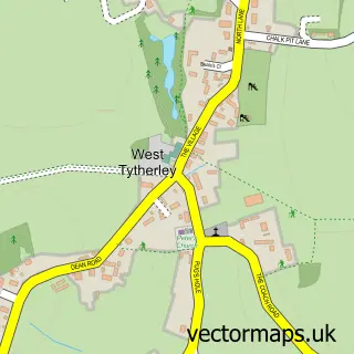
This Broughton street map is a detailed vector street map covering a 750m x 750m area. Select a larger area to create and download your own vector street map of Broughton.
The 750-metre map sample for Broughton covers 288 mapped buildings and approximately 10.7 km of road detail, of which 20 named roads are named. The immediate area includes 1 school and 2 pubs. The wider area around Broughton features 2 food and drink venues, 2 hotels and 1 campsite within 2 miles. To create a larger or custom map of Broughton, the map builder lets you define your own coverage area and download editable SVG, PDF and PNG files.
Create a larger editable map of Broughton
Choose any area you need and generate a high-quality vector map instantly. Perfect for print, planning, design, business and personal use.

This Broughton street map in Hampshire is available as downloadable SVG, PDF and PNG map files, or as a printed map for planning, business, display, education, local information and design work. You can also create a larger custom map area using the map selector.
What this Broughton map sample shows
Broughton lies within Broughton Cp parish, part of Mid Test ward in the Test Valley District local authority area. The postcode geography for this area includes the SO postcode area, the SO20 postcode district and the SO20 8 postcode sector. Residents fall under the Nhs Hampshire And Isle Of Wight Integrated Care Board for NHS services.
Local features near Broughton
Within 2 milesAmenities and services in and around Broughton.
Administrative and postcode information for Broughton
The local authority covering Broughton is Test Valley District, within the county of Hampshire. The settlement lies within Mid Test ward and Broughton Cp civil parish. The SO20 postcode district and SO20 8 postcode sector serve the immediate area. NHS provision in the area is delivered through Hampshire Hospitals Nhs Foundation Trust.
Nearby street map samples around Broughton


More street maps in Hampshire
750 metre map area coverage
Boundary, postcode and point of interest information for the 750m x 750m rectangle centred on this sample map.
Boundaries containing map centre
Constituency: Romsey and Southampton North Co Const
County: Hampshire County
District: Test Valley District
Icb: NHS Hampshire and Isle of Wight ICB
Parish: Broughton CP
Police Force: hampshire
Postcode District: SO20
Postcode Sector: SO20 8
Ward: Mid Test Ward
Nearby boundaries intersecting sample
No additional intersecting boundaries found.
Postcode coverage
POI category counts
Doctor: 2
Elementary School: 2
Hotel: 2
Post Office: 2
Pub: 2
Real Estate Agent: 2
Sports Club And League: 2
Architectural Designer: 1
Breakfast And Brunch Restaurant: 1
Brewery: 1
Sample points of interest
- David Barker Project Services
- Meadow Stockbridge
- Test Brewing LTD.
- Organic Earth Landscapes
- Hogget and Boar
- St Mary's Church
- Jellybeanz
- Broughton Community Shop
- Broughton Surgery
- School Lane Surgery
- Red Fox Soufflés
- B F Keane
Create a larger editable map of Broughton
This sample shows only a 750 metre area. To create a larger map of Broughton, use our map builder to choose your own coverage area, add titles and download editable SVG, PDF and PNG files.
Create a custom map of Broughton