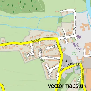
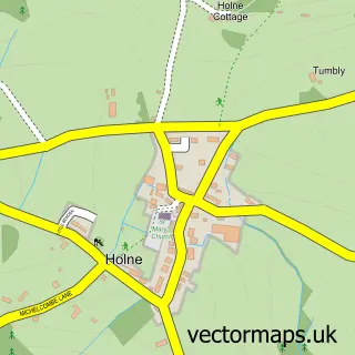
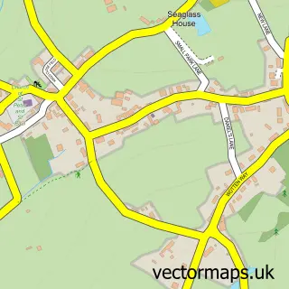
This Buckfastleigh street map is a detailed vector street map covering a 750m x 750m area. Select a larger area to create and download your own vector street map of Buckfastleigh.
The 750-metre map sample for Buckfastleigh covers 216 mapped buildings and approximately 16.9 km of road detail, of which 29 named roads are named. The immediate area includes 1 school, 1 GP surgery, 6 pubs and 1 MOT station. The wider area around Buckfastleigh features 4 tourism points of interest and 11 food and drink venues. To create a larger or custom map of Buckfastleigh, the map builder lets you define your own coverage area and download editable SVG, PDF and PNG files.
Create a larger editable map of Buckfastleigh
Choose any area you need and generate a high-quality vector map instantly. Perfect for print, planning, design, business and personal use.

This Buckfastleigh street map in Devon is available as downloadable SVG, PDF and PNG map files, or as a printed map for planning, business, display, education, local information and design work. You can also create a larger custom map area using the map selector.
What this Buckfastleigh map sample shows
Buckfastleigh lies within Buckfastleigh Cp parish, part of Ashburton & Buckfastleigh ward in the Teignbridge District local authority area. The postcode geography for this area includes the TQ postcode area, the TQ11 postcode district and the TQ11 0 postcode sector. Residents fall under the Nhs Devon Integrated Care Board for NHS services.
Local features near Buckfastleigh
Within 2 milesAmenities and services in and around Buckfastleigh.
Administrative and postcode information for Buckfastleigh
Buckfastleigh lies within Buckfastleigh Cp parish, part of Ashburton & Buckfastleigh ward in the Teignbridge District local authority area. The postcode geography for this area includes the TQ postcode area, the TQ11 postcode district and the TQ11 0 postcode sector. Residents fall under the Nhs Devon Integrated Care Board for NHS services.
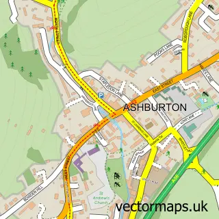
Nearby street map samples around Buckfastleigh

More street maps in Devon
750 metre map area coverage
Boundary, postcode and point of interest information for the 750m x 750m rectangle centred on this sample map.
Boundaries containing map centre
Constituency: Central Devon Co Const
County: Devon County
District: Teignbridge District
Icb: NHS Devon ICB
Parish: Buckfastleigh CP
Police Force: devon and cornwall
Postcode District: TQ11
Postcode Sector: TQ11 0
Ward: Ashburton & Buckfastleigh Ward
Nearby boundaries intersecting sample
No additional intersecting boundaries found.
Postcode coverage
POI category counts
Pub: 6
Furniture Store: 5
Community Services Non Profits: 4
Building Supply Store: 3
Coffee Shop: 3
Health Food Store: 3
Anglican Church: 2
Bakery: 2
Books Mags Music And Video: 2
Charity Organization: 2
Sample points of interest
- Devon Spelæological Society
- St Luke's Church
- St Luke, Buckfastleigh
- Refurnish at Buckfastleigh
- The Wool Hub
- (ERF) J. Searle & Son (Protected), 43 Fore Street
- Abbey Classics
- Dart Garage
- Hylsten Bakery
- Waldrons Patisserie LTD
- Lloyds Bank
- Barber
Create a larger editable map of Buckfastleigh
This sample shows only a 750 metre area. To create a larger map of Buckfastleigh, use our map builder to choose your own coverage area, add titles and download editable SVG, PDF and PNG files.
Create a custom map of Buckfastleigh